When we talk about fish finders today, we are really discussing integrated marine technology that combines sonar, map navigation with depth contours, radar, side scan, 3D images, and sometimes even autopilot. As a charter captain who has spent countless hours on the water, I have learned that understanding fish finder technology can improve your fishing success and allow you to navigate safely on the water.
Fish Finder Features
What fish finder you need really depends on the type of fishing being done and the other technology like radar and autopilots that needs to be compatible with the unit. As a charter captain, I like to have the state of the art electronics. Having good electronics is really helpful when you are on a boat for 12+ hours a day. In Alaska having a radar is basically required and having autopilot integrated makes trolling offshore possible without a deckhand.
The sonar itself is helpful in locating, bait, structure temperature breaks, and fish. Sonar is especially helpful when fishing for fish that stay near the bottom like, salmon, walleye, crappie, and rockfish.
In many cases, fish finders cost thousands of dollars more just to get a larger display. For this reason, it is important to know what features are included and not just assume that a more expensive unit is better.
Understanding Fish Finder Technology
How Sonar Works in Fish Finders
The clarity of sonar depends on both the power of the transducer and the frequency in which it’s used. When a fish finder emits sound waves through water, these waves bounce off objects (fish, structure, bottom) and return to the transducer. The unit calculates the time it takes for this echo to return, which determines the depth and location of underwater objects.
Relatively new CHIRP (Compressed High-Intensity Radar Pulse) Technology allows for a range of frequencies to be swept simultaneously, enabling accurate feedback at both shallow and deep depths. This significantly improves the detail and clarity of what you’re seeing underwater.
Transducer Frequency Options and Their Applications
Traditionally, there were two main frequency options:
- High-frequency band (around 200 kHz): Creates a wide beam that’s excellent at finding fish in less than 100-200 feet of water. These provide more detail but less depth penetration.
- Lower frequency signal (around 50 kHz): Produces a more narrow beam that works well at finding fish and structures below 100-200 feet. These penetrate deeper but provide less detail.
With CHIRP technology, the unit can sweep through multiple frequencies simultaneously, providing the benefits of both high and low frequencies.
Types of Imaging in Modern Fish Finders
Modern fish finders offer several types of imaging technology:
Down Imaging: Shows detailed images of what’s directly below your boat, great for seeing fish holding tight to structure.
Side Imaging: Displays what’s to the sides of your boat, allowing you to scan large areas quickly and find structure that might hold fish.
3D Imaging: Creates three-dimensional views of underwater terrain and fish locations, making it easier to understand the relationship between fish and structure.
Fish Finder Options
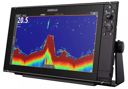
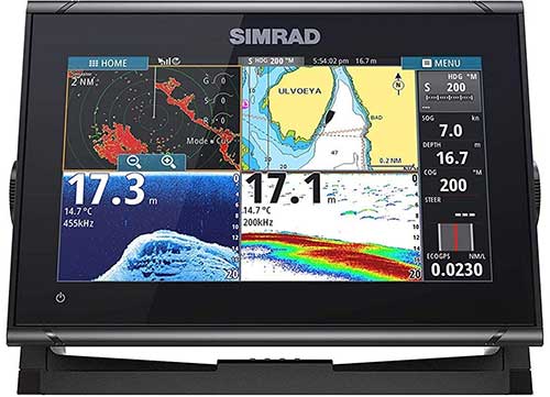
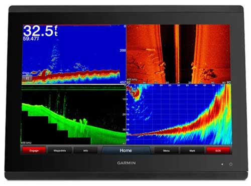
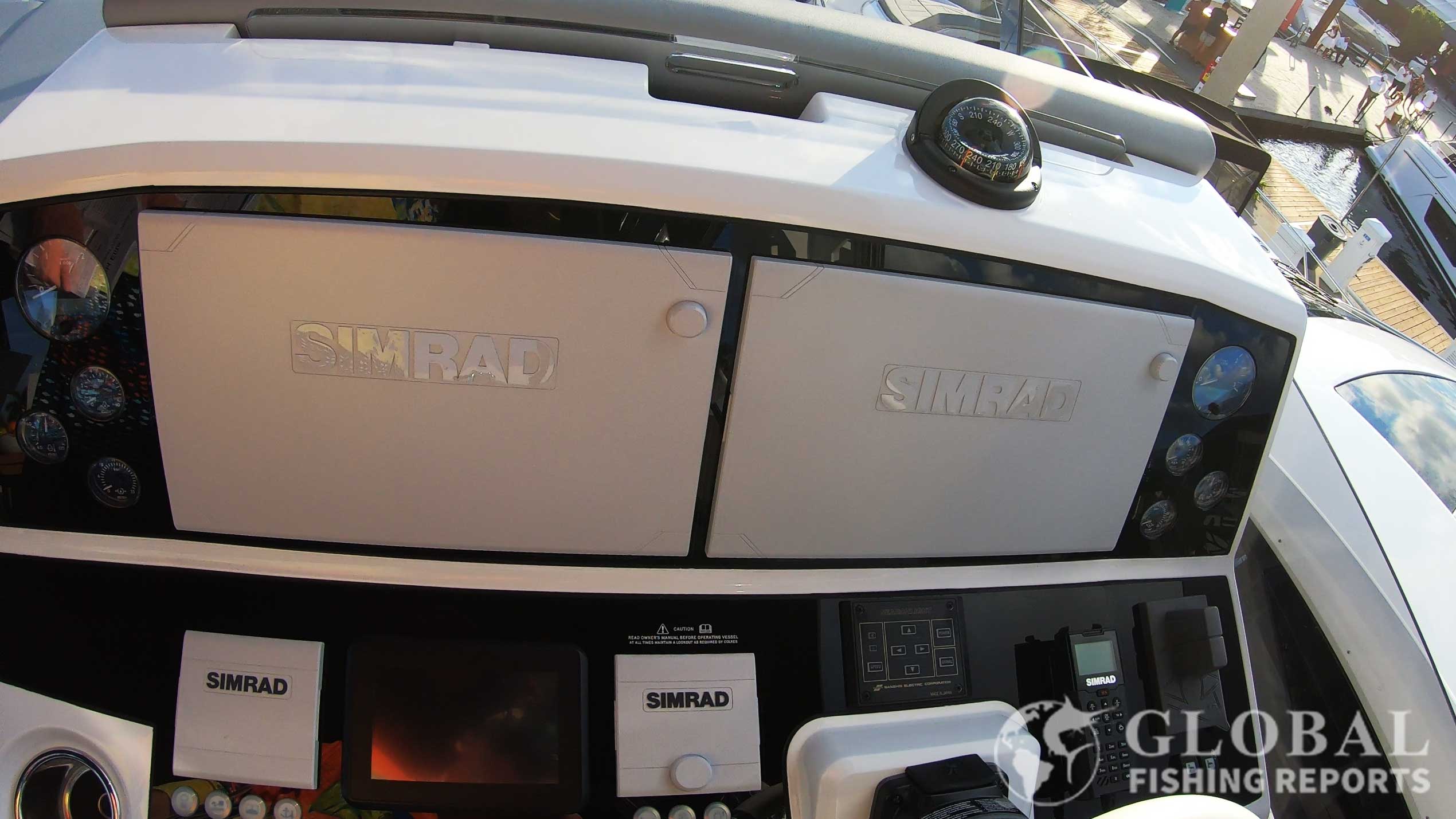
1. Simrad NSS or NSO evo3s Fish Finder
Buy from Amazon
Shop Bass Pro Shops
Estimated Price: $2,240-$12,200
The Simrad NSS evo3s comes in 9-inch, 12-inch, and 16-inch sizes. Simrad’s NSO evo3s display is 16-inch, 19-inch, or 24-inch. The NSS version is a powerful unit with the SolarMax IPS display, six-core processor, 1kW Chirp Sonar, and advanced networking options. This version is a top-of-the-line unit that is great for most recreational and professional anglers. It can be in integrated with autopilots, radar, sonar, and smartphone devices.
The NSO version is typically installed in luxury yachts and has the option to be integrated with the NSO eveo3s processor. It has the iMX 8 high-performance processor. The main reason to get the NSO version is the get the larger 19-inch or 24-inch displays, however, these larger sizes are significantly more expensive.
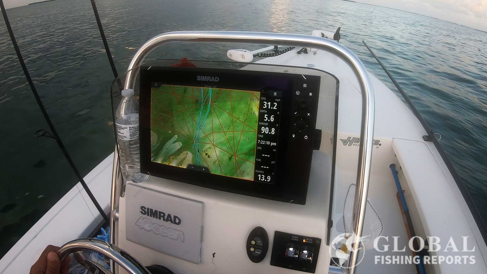
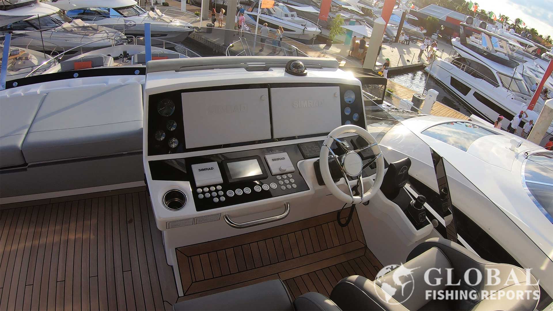
I use the NSS unit on our flats boat in the Florida Keys. In the video below I discuss why this is the best fish finder on the market. We have Florida Fish Tracks installed which provides detailed terrain maps that allow for easy navigation through channels and shallow water. As I looked around at the Fort Lauderdale boat show I was also surprised to see these unites of many mega yachts such as Sunseeker yachts. So this fish finder is versatile enough to be the best on an 18-foot flats boat or an 80-foot luxury yacht.
In the video above I explain why Simrad makes the best fishing finder. This fish finder is a 16-inch Simard with the Florida Marine Tracks chip installed. The chip shows the best path to travel on during high and low tiedes. This makes navigating in shallow water much easier.
Simrad also has C-MAPS and CMOR relief shading that shows the 3D structure of the bottom. This does need to be purchased separately on a chip. Garmin also has relief shading apps but CMOR mapping can not be used on a Garmin device. In the past, I would recommend Garmin as the best fishing finder. However, I think that Simrad has taken over and is the best in terms of navigation, sonar quality, and ease of use.
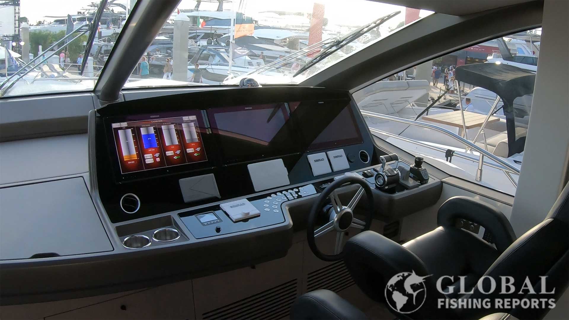
Multiple Simrad units are commonly used on large luxury Yachts. The picture shows three large Simrad displays on a Sunseeker Yacht.
2. Simrad GO9 GO12 XSE with Sonar Transducer Package
Buy from Amazon
Shop Bass Pro Shops
Estimated Price: $700-$2,550
This Simrad GOfish finder series comes in a 5-inch, 7-inch, 9-inch, and 12-inch display versions. The transducer included is the active image 3 in 1. It is able to get data for side scan, down scan, and CHRIP. The display can show up to four screens at one time. This is nice as the chart plotter navigation can be used in conjunction with the sonar and side-scan. Using these at the same time is a quick way to locate and mark underground structures and wrecks that are holding fish.
Radar can be integrated to track weather and navigate in foggy conditions. A phone or tablet can be connected wireless to the unit. This allows the screen to be displayed in more than one location on the boat. Often time anglers have to buy two full systems just to get the display in two locations. Using a phone or tablet is nice just make sure to run power to the screen when using it on long trips.
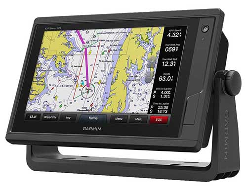
3. Garmin GPSMAP 743 943 1243 with Touchscreen
Buy from Amazon
Shop Bass Pro Shops
Estimated Price: $1,100-$2,900
The Garmin GPSMAP comes with a 7-inch, 9-inch, or 12-inch touch screen display. There is a large price difference based on screen size as the 7-inch retails for around $1,100 the 9-inch is around 1,400 and the 12-inch costs around $2,900. This unit is compatible with radar, weather, sonar, VHF, camera, wind sensor, and AIS. On the back of the unit, there is an NMEA 2000 connection that allows this unit to work with autopilots.
The GPSMAP 743xsv, 943xsv, or 1243xsv is the newer model of the GPSMAP 742xsv, 942xsv, or 1242xsv which were very popular models. The new versions have a higher screen resolution and processor that is almost twice as powerful. If you get the xsv versions the unit will work with Sidevu, Clearvu, mapping, and traditional sonar which are all typically included. There is an xs or standard version that is significantly cheaper that uses the traditional CHIRP and downVu sonar which is typically not included with the purchase.
The touchscreen series of Garmin fish finders are my favorite to use. As a charter captain if I was buying a boat I would get a Garmin with a 12-plus inch display. My favorite features of this device are the basic fish finder capabilities and easy-to-use navigation. With the touch screen, you can just tap the screen where you want to go on the map and hit goto. If an autopilot has been integrated taping the engage button will drive the boat straight to that location. The navigation charts are very detailed and are a must-have when navigating in shallow water areas.
I always wondered if would I rather have buttons and a knob or a touch screen. Often times when fishing my hands are wet and slimy. However, after using both for long periods of time I have concluded that having a touch screen is way nicer! When fishing inshore or offshore this is a powerful unit to have on the boat.
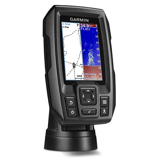
4. Garmin GPSMAP 86 Series with Transducer
Buy from Amazon
Shop Bass Pro Shops
Estimated Price: $2,800-$12,000
The Garmin 86 series are the best marine chartplotters that Garmin makes. The modes are 8610, 8612, 8616, 8617, 8622, and 8624 for 10-inch, 12-inch, 16-inch, 17-inch, 22-inch, and 24-inch sizes respectfully. The actual diagonal display dimensions are a bit smaller than the unit size given.
Differences between the 1242xsv and the 8612xsv are mainly the screen resolution and types of transducers that can be used. The 86 series units have a full HD 1920 x 1o80 display compared to 1280 x 800 pixels for the 1242xsv. Also, the 86 series can use the ultra high definition transducer for improved sonar clarity.
The larger screen sizes cost significantly more money. For example, the 10-inch version retails for around $2,700 while the 24-inch version cost around $12,000. The reasonable price point with an easily viewable display seems to be the 12-inch display for around $3,500 which is very popular. I know of several boats that mount two 12-inch units side by side near the driver’s seat and have an additional 12-inch display near the rear of the boat to view while trolling with downriggers. If you spend a lot of time using the fish finder and navigation it very well may be worth paying more for the large display sizes. The best size display is based on the vessel, user preference, and budget.
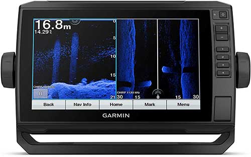
5. Garmin EchoMap UHD Fish Finder
Buy from Amazon
Shop Bass Pro Shops
Estimated Price: $700-$2,950
The Garmin EcoMap UHD fish finder comes in 4-inch, 6-inch, 7-inch, 9-inch, 10-inc, and 12-inch color displays. Sv units come with a transducer that works as a side scan, clear view, and CHIRP sonar. The cv units are similar but do not have the clear view option which offers a wider field of view under the boat. It comes with Navionics charts preloaded for US Coastal waters in the ocean. Being able to see depth contours is important for safe navigation and finding fish. The screen can be controlled with the buttons on the right side of the touch screen.
There are several model options to choose from. The 92sv has only a worldwide base map, 93sv has LakeVu g3 Maps with data from 17,000 lakes in the USA, 94sv has BlueChart g3 with US coastal data, and 95sv has data for lakes in Canada.
A power cable and dashboard mount are included. This is a good unit for freshwater or saltwater use. NMEA cables allow for an autopilot to be set up with built-in navigation. This unit is compatible with the Garomin Panoptix Livescope scanning sonar which is an impressible technology. The Livescope is similar to a video camera since it shows a constantly updated live display. It points to the side and down and shows the side profile of fish and structure.
6. Garmin Striker Plus 5CV 7CV 9SV and Striker Vivid
Buy from Amazon
Shop Bass Pro Shops
Estimated Price: $320-$620
The Garmin Striker Plus has a 5-inch, 7-inch, or 9-inch color display that is readable in sunlight. This is a similar model to the striker 4 plus but instead of having the buttons underneath the display, this model aligns them on the right-hand side with a wider screen. There is also a new striker Vivid option on the market which offers new color palettes. It is basically the same as the Striker Plus but you can change to the color of the screen if you want.
The display is capable of split-screen viewing configurations and includes split-screen zooming. Of course, you’ll be getting your hands on that sweet Garmin ClearVU scanning technology which allows for incredibly concise and clear downward imaging, capable of creating imaging contours at 1-foot margins.
Furthermore, you’ll get the power of Garmin 5Hz GPS which is capable of being used as a split screen with your fish finding or imaging display.
7. Garmin Striker Plus 4 and Dual Beam Transducer Package
Buy from Amazon
Shop Bass Pro Shops
Estimated Price: $140-$160
The Garmin Striker Plus 4 has a 4.3-inch color display. This is the same Striker we love from the previous review with a slightly larger and better contract display and a dual-beam transducer set-up, meaning you can use the CHIRP equipped sonar that sweeps through 50/77/83/200 kHz.
Fish finds are especially helpful at marking fish that live to near the bottom like salmon, walleye, crappie, and rockfish. For fish that do not swim in schools and or near the bottom, fish finders are most helpful to locate baitfish that predator fish might be feeding on.
This model is a bit better for those of you wanting a bit more control over the sonar configuration. Like the Striker 4 base model, this one includes the Garmin ClearVU-3D scanning function and also utilizes a 6-button layout, just in a slightly larger form factor.
8. Garmin Striker 4 and CHIRP Transducer Package
Buy from Amazon
Shop Bass Pro Shops
Estimated Price: $140
The Garmin striker comes in 3.5-inch, 5-inch or 7-inch color displays with waterproofing. The CHIRP transducer uses 77 kHz-200 kHz sweeping frequency band with a maximum depth of 1600 feet.
If you just need a sonar unit in depths less than 50 feet this is a great low-cost fish finder that will mark fish and shop accurate depth. A major leader in the fish-finding tech sector is Garmin, which means you’ll see several of their top models on this list, and for good reason, they’re well made and priced fairly.
The Striker 4 is incredibly cheap at just above a hundred bucks but manages to include a very user-friendly GPS system and a very powerful CHIRP transducer. It’s affordable, it has what you need, and it gets the job done well with an adjustable transducer that’s capable of fitting the bill in most casual situations.
This particular unit also comes with the Garmin ClearVU scanning function and an easy-to-use mount. A six-button set on the unit is easy to use and it even comes with a built-in flasher for ice fishing or vertical jigging.
In the video below the Striker 4 is compared to the striker plus 4. The striker plus 4 plus is reviewed as option 7 in this article.
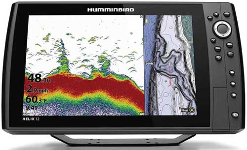
9. Humminbird Helix 12 and 15 CHIRP Side Scan and Down Imaging
Buy from Amazon
Shop Bass Pro Shops
Estimated Price: $2500
The 12-inch and 15-inch Humminbird Helix is a top-of-the-line fish finder for freshwater fishing. It is controlled with the buttons on the right side and is not a touch screen. The large 12 to 15-inch screen allows the user to see the great imaging options of the unit in proper detail. These imaging features include Mega side imaging, Mega down imaging, CHIRP, Chart with GPS location, and maps with depth contours. The transducer, wiring harness, and bracket for mounting the fish finder are included.
This is a fish finder used by Bass fishing professionals. It can be mounted at the front of the boat near the bow mount trolling motor or near the dash by the searing wheel. The Chirp sonar and down imaging allow fish and structure to be easily seen directly below the boat. Side imaging allows for more area to be viewed which results in more likely find the structure that is holding fish. Using the maps with depth changes is a good way to find drop-offs and ledges that often have high concentrations of fish. Another similar unit that is also good is the Humminbird Solix 15.
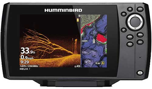
10. Humminbird Helix 7 CHIRP GPS G4N
Shop Bass Pro Shops
Estimated Price: $720-$930
The Helix 7 CHIRP Mega Down Imaging package from Humminbird has a 7-inch sunlight-readable display. This unit comes equipped with a powerful GPS receiver that offers your choice of storing 2500 waypoints and 50 different custom routes. The fish finder also comes equipped with an expandable storage slot fit for a single Micro SD card, in case that 2500 waypoints weren’t enough! To boot, the unit comes with Lake Master, Auto Charting Pro, and Navionics+, which work great for navigating and charting needs.
The G4N version is different from the G4 version because it has advanced networking and includes Mega Live Imaging, dual micro SD slots, ethernet networking, ipilot link, wi-fi, and chirp radar. If these are not features you plan to use the G4 version is significantly cheaper.
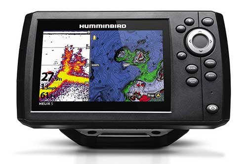
11. Humminbird Helix 5 G3 CHIRP Chip Package
Shop Bass Pro Shops
Estimated Price: $310
The Hummingbird Helix has a 5-inch multi-view display with a tilt mount included. Expandable SD memory allows for additional waypoint and map storage.
You’ll get built-in GPS capabilities, Humminbird’s 2D low-power sonar system, SwitchFire detailed bottom charting, both wide and narrow beam configurations, and a powerful 4000W sweeping frequency CHIRP transducer capable of both down imaging up to 2500 feet and clear side imaging.
Humminbird has a nice little collaboration with LakeMaster and NOAA that allows them to include powerful base maps from the most trusted fishing sources. With Humminbird’s powerful Live Autocharting feature, you can record up to 8 hours of custom charting, all recorded seamlessly as you travel around.
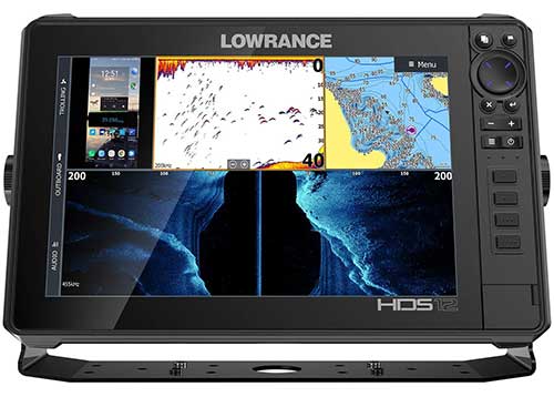
12. Lowrance HDS-12 Live Fish Finder
Buy from Amazon
Shop Bass Pro Shops
Estimated Price: $3,500
This unit comes in 7-inch, 9-inch, 12-inch, and 16-inch sizes. The features of this unit include StructureScan 3D, StructureScan HD, Mercury VesselView Link, and Lowrance’s Outboard Pilot software.
The Lowrance HDS-12 Live is fully capable of integrating with your mobile device via WiFi connectivity and touts the most advanced fish-finding technology to ever hit the market thus far.
The sonar is in a proprietary color scheme that utilizes high-visibility contrast to enhance the usability of its advanced sonar capabilities. Speaking of sonar, this unit does it all, from down and side sonar to full 3D and HD scanning, the quality is unmatched. Of course, it comes with a powerful 10Hz GPS system that supports WAAS, EGNOS, and MSAS. A huge advantage to using this fish finder is its capabilities of tethering together multiple sonar systems to create an all-encompassing 3D image scan. With the HDS-12 Live, you’ll be able to mount multiple different transducers on your watercraft and link them together to create a full sonar network.
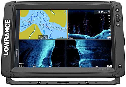
13. Lowrance Elite TI2 W Med High Skimmer Transducer
Buy from Amazon
Shop Bass Pro Shops
Estimated Price: $2,070
The Lowrance elite series comes with display sizes of 5-inch, 7-inch, 9-inch, and 12-inch. The Elite-12 TI is the premium level of the Lowrance lineup. Here you’ll find those make-or-break functions that are more than worth the money if you’re serious about fishing. Let’s start with one of the biggest difference-makers here – the transducer.
Lowrance has developed its own proprietary CHIRP-equipped transducer called the Med/High Skimmer. This transducer has quickly become a top choice among fishermen from both the entry-level to the most advanced fishing operations.
This HDI transducer utilizes the power of DownScan Imaging processing and its multi-beam Med/High CHIRP sonar to create powerful photo-like images of structures, fish coverage, and target differentiation.
Something that truly stands out with this particular imaging system is its ability to track and portray each individual fish in a tightly packed school of fish where other units may only be capable of showing a solid mass of blobs. Furthermore, using StructureScan HD, you’ll be able to identify very clearly where and what the fish are congregating around with ridiculous precision and image quality.
The actual display is a beautiful and touch-capable 12-inch monitor with Trackback software, allowing you to review historical data no longer displayed on the unit. This allows you to easily compare and return to areas of interest and since the Elite TI comes with intuitive navigation tools, you’ll be finding and saving the locations of each and every one of the best fishing spots!
The system as a whole is highly connective with full mobile phone integration via WiFI and Bluetooth connectivity. You’ll have access to MotorGuide Xi5 trolling motor software, C-MAP Genesis updates, Power-Pole Anchors, SonicHub 2 marine audio, and more. Furthermore, your system can connect with NMEA 2000 to provide instant access to engine monitoring software, waypoint location sharing, and SmartSteer trolling navigation.
It’s important to note that there are smaller and less expensive Elite models available, but some may lack the features of the larger units, such as the Elite 5 TI not having MotorGuide control.
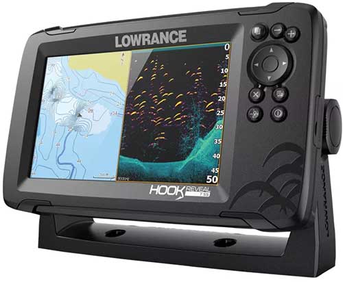
14. Lowrance Hook Reveal
Buy from Amazon
Shop Bass Pro Shops
Estimated Price: $270-$935
The Lowrance Hook Reveal is the newer model of the popular Hook-2. This model is an improvement though across the board. The Reval comes in display sizes of 5-inch, 7-inch, and 9-inch. These units utilize the latest SolarMAX high-resolution screens. One of the most intuitive and customizable experiences ever offered in a fish finder, the Reveal was designed around the idea of automatic adjustments.
There are two transducers offered for the reveal which are the SplitShot, and Triple Shot. The TripleShot is the larger traducer and provides DownScan, SiseScan, and CHIRP.
The Reveal comes with very easy-to-use navigational tools including Navionics, GPS plotter, pre-loaded C-MAPs, and a birds-eye view of 1-foot contour lines on over 4000 different bodies of water in the US.
With the Reveal you choose your screen size, transducer type, install, and the unit will automatically adjust its configurations to best match the conditions and type of fishing you’re currently doing. This happens without the need for human intervention.
The SplitShot transducer is a 2-in-1 sonar package that utilizes both CHIRP sonar technology and Lowrance’s advanced DownScan imaging. These work together to form a comprehensive and complete image of all the swimming creatures, bait balls, and structures under the waves.
If the side scan feature is not important for the type of fishing being done I would recommend the SplitShot transducer as it is a smaller transducer. Sometimes large traducers spray water while running if not mounted high enough on the boat.
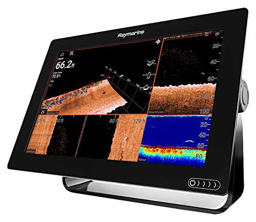
15. Raymarine Axiom With RealVision 3D and RV-100 Transducer Package
Buy from Amazon
Shop Bass Pro Shops
Estimated Price: $1,250-$1,550
The Raymarine Axiom is available in either 7-inch, 9-inch, or 12-inch displays. The features include RealVision 3D image processing, SideVision, DownVision, 3D fish finder, and powerful CHIRP sonar. This is really one of the most feature-rich technologically advanced units on the market today.
It’s powered by a quad-core processor running on the Lighthouse 3 operating system. This multi-touch interface is by far one of the highest resolutions and best overall looking screens I’ve seen in fish finders.
The RV-100 transducer is a CHIRP enabled 600W monster with the option to use a dual beam 50/200kHz frequency configuration. This unit is capable of displaying sonar imaging from the side, underneath you, and in the RealVision format all on the same screen!
The Axiom fishfinder comes with full mobile integration via WiFi connectivity that allows you to transfer and save data and also control most of the features on the unit itself from your smartphone.
You’ll also get Navionics+ charting programs that cover over 20,000 bodies of water in the US and Canada.
Worthwhile mentioning, this thing is absolutely insane when it comes to functionality. You can watch Netflix, stream Spotify, integrate with drones or security cameras, and add more radar functionalities. This is truly a full-service boat media hub that so happens to be highly effective at finding fish! If you don’t mind paying a premium for a beautiful and powerful technological upgrade for your precious watercraft, this is the fish finder for you!
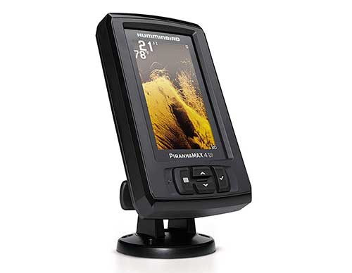
16. Humminbird PiranhaMax 4 DI Down Imaging
Buy from Amazon
Shop Bass Pro Shops
Estimated Price: $160-$170
Not as well known as Garmin but arguably of similar quality, Humminbird’s PiranhaMax is a neat little 4.3 inch fish finder. This particular unit focused on downward imaging and touts an impressive 2400w peak power output. Dual-beam down imaging capable of looking down up to 600 feet in a narrow or wide beam angle configuration. There is also the Piranhamax PT which is a protable fish finder that comes in a back where the transducer can mount the the back of a small boat or kayak using a suction cup. It does need to be connected to an external 12 volt marine battery.
Humminbird’s Fish ID+ makes spotting fish a breeze and since there are only 4 buttons, this unit is extremely user-friendly. To make matters even better, its equipped with dual beams, allowing for a fantastically wide range of down imaging.
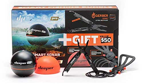
17. Deeper Pro+ Smart Portable Castable Sonar
Buy from Amazon
Shop Bass Pro Shops
Estimated Price: $180-$300
Something a little different here is the Deeper Pro+ castable sonar unit, which is simple to use and extremely effective for those of you fishing from the bank or a kayak. It is capable of casting out 330 feet and scanning to depths of 260 feet The deeper app can store and share information with ease. Bass Pro Shops has the deeper smart sonar with CHIRP.
Like the title suggests, you attach this to your fishing pole, cast it out into the water, and then using the power of WiFi, you obtain all of that sweet information regarding the whereabouts of those pesky fish. But wait, there’s more!
This bad boy has built-in GPS and will automatically build contour maps for your viewing pleasure. Figure out where your favorite lures will get lost BEFORE casting them into oblivion. Of course, you’ll also get depth data, water temperatures, and several other tidbits of important information.
If you buy the gift kit, you’ll get a night cover that lights up your fish finder, a Gerber multi-tool, a tactical-looking smartphone holder, and a nice little carry bag.
Modern Fish Fish Finder Technology
Fish finders have come a long way over the years and now they’re packed with tons of extra features. Some are vital to a fishing trip and some simply to make the trip more enjoyable. When shopping for a new fish finder, it’ll be helpful to understand the following terms. Some of these are fantastic additions to a fish finder that you may really appreciate having. Others simply drive up the price of the unit with features you may not actually need. It’s important to keep in mind that some of the following terms may have other names signifying similar technologies that are branded by different manufacturers.
GPS/Navigation
If you have a cell phone with Google Maps then you know what this does. GPS-equipped fish finders allow you the freedom to ditch the distracting cell phone without ditching your trusty navigation tools.
Satellite Radio
Simply put, new age fish finders are including satellite radios to ensure you’ve got access to your favorite stations despite fishing out in the middle of nowhere. We all know that one spot in the lake that seems to have the most fish but is in between two massive hills that block the radio towers. With satellite radio, you won’t need to rely on towers any longer.
Chart Plotting
Chartplotters are handy little tools that are entirely location-based. It’ll show your current location, past locations, historical depth readings, contours, and depending on the chart plotting software installed. These are especially handy in charting specific fishing routes, setting waypoints, marking things of interest or hazards, and remembering hot fishing spots. Recently, chart plotting systems have been aiding in filtering historical information too.
StructureScan
With the implementation of a 3D capable transducer, StructureScan software builds a three-dimensional topographical image of the seafloor. This provides significantly more information about the underwater landscape than a traditional 2D imaging processor. With this feature, you’ll better understand where the fish are located and what they’re hanging out next to. Structure limbs, rocks, caverns, etc. can be viewed. StructureScan is actually trademarked by Lowrance. There are many other similar features implemented by other manufacturers by other names such as the Garmin RealVu 3-D.
Bottom Discrimination
Kind of similar to StructureScan, this allows the fish finder to display the actual makeup of the bottom and determine whether its mud, sand, gravel, or rock. This works by analyzing the strength of the bounces from your transducer to determine hardness. This comes in handy when picking fishing locations, often certain types of fish live on different bottom types.
AutoChart
Features like this can be named many different things, such as Hummingbirds Autochart Live. These allow you to create an entire real-time chart based on the sonar readings to create your own personal detailed view of the bottom. Furthermore, you can use this tool to compare historic maps with real-time data to determine changes and shifts such as a new depression. Maps that are more accurate can be made and compared to look for good fishing spots.
SwitchFire
This is a special image post-processing system that filters out the “noise” in a sonar image. Simply put, this makes the image clearer and easier to gather important information from. This system can also help to process images being interfered with by turbulence.
Post-Gain Processing
A handy little software trick that automatically adjusts the entire image, even historical data, with your new display settings. Traditionally, if you changed a setting on your display, you’d have to wait for new data to pop up before the unit uses your new settings, but with post-gain processing, the unit automatically converts all existing information according to the new configuration.
History Scroll Back
Simply put, this allows you to backtrack over previous data your fish finder has displayed but no longer shows on the screen. Handy for comparing different fishing holes and comparing chart plotter data.
Split-Screen and Four-Way Viewing
Self-explanatory here. Your display will allow you to set up multiple partitions on the screen to display different data sets and monitoring systems.
Wi-Fish
For our social media fiends out there, Wi-Fish utilizes a black-box sounder and pairs this with your transducer and your smartphone to give you full fish finder capabilities in the palm of your hand, ready to share to social media! No more lame photos of the screen of your fish finder, upload high-quality real-time screenshots and share data of your fishing trip to your pals! As a final note, Wi-Fish also lets you scroll back up to 60 seconds on your smartphone, letting you analyze data that may have already disappeared from your fish finders display.
Fish Finder Basics
Fish finders are an evolutionary piece of sonar technology that was originally found in the form of a fathometer. The fathometer was widely used for navigation, displaying the water depth, and other general oceanographic information. The root word of the fathometer, the fathom is a unit of measurement for water depth.
Fathometers worked by transforming electrical pulses into sound waves via an underwater transducer (AKA Hydrophone) and using the reflected sound waves to record data, such as size, composition, shape, depth, location, movement direction, etc. The reflection data is gathered using some pretty complex math equations, which we’ll talk about more in-depth in the next section.
The original fathometer used for recreational purposes used a rotating ray of light at the edge of a circle which flashed with every echo received, which is how it showed the user depth. The faster the flash, the closer the bottom was to the boat. In bright light on a sunny day, this was terribly difficult to utilize and to make matters worse, if the waters were rough, they were nearly unusable due to accuracy issues. Furthermore, they gave off brief quick flashes indicating fish, but a quick couple of flashes was all you got in terms of fish finding functionality.
Some really smart oceanography scientists (anglers at heart) realized they could use similar technology to find the location of the creatures swimming under them and display them onto a screen with a limited amount of tracking over time, thus, the modern-day “fish finder” is born.
How Fish Finders Physics
This section will be a bit technical, so if you don’t care about the math and science behind fish finders, you could skip this section! If you’d like to learn more about fish finders as to better interpret their data and set yourself apart from the weak anglers, read on!
Starting with math, fish finders use this approximate equation to determine the speed of their manufactured sound waves through water: C = T – T^2 + S + D.
C is the speed of sound (m/s)
T is the temperature in Celsius of the water
S is the salinity per mile (amount of salt in the water)
D is the depth of the water currently being measured
A modern-day fish finder will re-record and calculate this data up to 40 times per second and chart this data on a graph.
We mentioned that the fish finder is sending sound waves through the water to determine the distance and position of fish and the seafloor. How sensitive (the frequency of sound waves) will determine the amount of location accuracy. Using a higher frequency will result in much faster display times and more accurate and more detailed displays, however, higher frequencies penetrate matter with less efficiency, making lower frequency superior for extreme depths. Most instances of commercial fishing such as deep-sea trawling use an optimum range of frequencies in the 50-200kHz, making their display a bit less detailed than what you’d use to go bass fishing.
When looking at the graphical display of your fish finder, it’s important to note that what is in the middle of the screen isn’t always what is directly under your boat. Instead, the x-axis is actually showing time, meaning the left portion of the graph is what your transducer has already passed over and recorded. What’s directly under your transducer is at the far right in most units.
Keeping this in mind, lower-end units fail to track this data accurately at high speeds. If you’re traveling at high rates of speed, the graph may lack data and will be less accurate, creating imaging distortion. Image distortion is heavily based on the speed of your vessel versus the update rate of the fish finder. This means that if you plan on locating fish while on the move, you’ll need to opt for a fish finder that has a high refresh rate, close or at 40 refresh rates per second.
Another interpretation tip includes something called “fish arches”. The newer more advanced units are getting better at solving this problem, but most units on the market today still suffer from fish arches. In a nutshell, a fish arch is shown on the fish finders display as an odd arch off the bottom of the seafloor and not an actual fish icon. This happens due to a fish entering the leading edge of the sonar beam, activating a display pixel, and recognizing there is something there.
As the fish moves towards the center of what your sonar is recording, the distance from the fish to the bottom of your boat decreases, tricking your fish finder into thinking the depth is reducing and that the boat is nearing the seafloor. As you pass over the fish, the sonar begins to display a drop-off as the fish gets further away from the bottom of your boat, and voila, you have an awkward arch displayed on your fish finders screen!
Fish arches can happen frequently when there are large numbers of fish all gathered up together or there is a school of tightly packed baitfish. To identify whether or not there really is some kind of structure underneath you or it’s fish, you’ll have to pay close attention to the thickness of the lines given to you on the display. Schools of fish will usually display a very thin line around the arch that otherwise should be thick if it really was the seafloor.
As a last little tip for interpretation, some fish finders are capable of picking up on your fishing line and the lures attached to them. You may notice slim lines falling from the top to the bottom, and you guessed it, that’s the path of your gear! In optimal temperatures and water oxygen levels, you can use this to determine the depth of your lure set.
Fish Finding Power
I’ve mentioned how important the frequency at which your fish finder operates in before, but let’s go ahead and expand on that so you can find the perfect unit for your situation.
A quick recap of what I mentioned before, the higher the frequency, the higher the detail your fish finder will offer, but high frequencies cannot penetrate as deep as lower frequencies, decreasing their range.
High frequencies = less range and area of view but offer higher definition
Low frequencies = higher range and more area of view but at a cost of lower definition
For shallow-water angling less than 200 feet, I’d choose higher frequencies such as 200kHz to 800kHz, and for depths exceeding 200 feet, I’d recommend 80kHz or even lower, at 50kHz for extremely deep fishing.
Fishfinders can come in a variety of frequency capable modes, including single-band, dual-band, multi-band, or broadband CHIRP systems.
Single-frequency fish finders will likely be cheaper but only offer one frequency, meaning you should purchase this particular unit for a particular type of fishing and depth.
Dual-band equipped fish finders typically have a high and a low setting, letting you switch between two general levels, offering more of a range in the depths your fish finder will excel in. Some of these may also transmit in both available frequencies at the same time, offering the best of both worlds simultaneously.
Multi-band fish finders will either have several presets you can choose from, giving you a wide variety of choices or they will allow you to specifically choose a frequency, giving you ultimate fine-tuning control over your fish finders transducer.
Compressed High-Intensity Radar Pulse (CHIRP) systems use a linear sweeping method that gradually increases the frequency to find incredible detail at the most efficient frequencies possible. Think of this as an automatic adjusting style of the fish finder. An example of this would be a sweep from 40 to 80kHz, 120 to 250kHz, 400 to 800kHz, and so on. These are best used for extreme depths, such as 10,000 feet.
CHIRP fish finders actually utilize and send less total peak energy than other fish finders, however, their modulated wide-band pulses are much longer in duration and can put up to 50x more energy through the water. CHIRP-equipped devices use digital pattern matching and signal processing to achieve much greater resolution levels than their non-CHIRP counterparts and have the ability to target individual fish at great depths that are only inches apart from each other. Most fish finders without CHIRP will identify groups of fish as one solid mass, but a CHIRP-equipped unit can identify each and every fish separately, giving you an accurate estimation of how many fish are available and where each one is specifically.
Another important aspect of a fish finder is the wattage or overall peak power capability of the unit. The measurement you’ll see is in watts RMS (root mean squared). The amount of power a fish finder is capable of producing will determine its ability to blow through silt and light debris, achieve greater depth ranges and identify specific targets.
Inland lake fishing only necessitates roughly 200W while anything less than deep blue fishing would likely only need roughly 500W. Deep-sea fishing may require 1000W or more to reach the required target depths.
Finding the perfect frequency, whether it be a single frequency unit for the weekend lake dweller or a CHIRP-equipped monstrosity, and pairing it with the proper wattage level is crucial for an optimum fishfinding experience.
Directional Targeting
Yet another specification you’ll need to widely study and pay attention to before you take the plunge on a new fishfinding unit is the directional area of view the fish finder is capable of. Some fish finder transducers have 360-degree capabilities, but of course, those are the more expensive options and many people may not need that.
Side imaging utilizes thin beams of sonar to scan 180-degrees roughly 240 feet left and right of your watercraft. This aids the fish finders computer chip in rendering a more accurate picture of the seafloor.
Down imaging is pretty self-explanatory and what most typical fish finders do. These shoot sonar waves down from their mounting point to create an image of what’s underneath your watercraft.
360 Imaging is basically side imaging on steroids. This is especially useful for net casting as you’re able to avoid potential snags and mark structures hidden just beneath the surface in any direction of your transducer.
Something popular you’ll likely come across when comparing the specifications of units is the “beamwidth” or “cone angle”. Simply put, this is how wide the beam is that is coming out of your transducer and gathering that sweet honey hole of information.
Fully explaining beam angle would really be better suited in a guide of its own, so I won’t go there for now. However, I will provide some tips and tricks here to help you get on your way!
A narrow beam angle is best used for specific locations, such as wreck and structure fishing. A beam angle of 9 to 15 degrees makes for incredibly focused detail due to the sonar energy being cast into one small area, creating a higher resolution picture. This helps define edges and barriers the structures may contain, making lure placement much easier. With a narrow beam, you’re sacrificing the total area scanned for higher detail, which makes finding fish on the move a more difficult task.
A wider beam angle greatly raises your chances of picking up fast-moving fish or finding fish while you’re motoring around. Wide beams such as one in the range of 40 to 45 degrees are excellent for fishing tournaments as they greatly impact how quickly you find pockets of fish. Mixed with an extremely powerful transducer (high wattage) and a low frequency, these are among the best at generally spotting fish and locating a potential sweet spot. The downside to using a wide-angle is that structures aren’t as crisp looking, making edges less definable and things lying on the bottom a total blur.
A medium beam angle, such as something in the 20 to 30-degree area, makes for a decent middle ground of detail and coverage. You’ll sacrifice pinpoint details that will make edges of structures appear slightly blurred and you won’t be able to cover as much ground as a wide-angle, but you’ll essentially get the best of both worlds scenario.
Beam angle, frequency, and power all work together to create the picture you receive on your display and to help you find productive waters, so it’s important to understand all three of them and choose something that fits your style of fishing. All three of these components need to match up and play to each other’s strengths. To do this effectively, you need to plan ahead and have a rough idea of what type of fishing you’re going to be doing, how deep those fish will be, and how difficult it will be to find them.
For example, using highly penetrative frequencies such as 50kHz with a low-powered wide beam wouldn’t make much sense because the frequency would be best used for deeper water while a low-powered wide beam wouldn’t be capable of delivering much detail at great depths.
If you’d just like an end-all-be-all piece of advice unless you’re competing or very serious about fishing, I’d recommend you to just get a 20 or 25-degree cone angled-down imaging transducer and be done with it.
Boat Transducers
Aside from power, frequency, and beam angle, we have to consider how the construction of our watercraft affects the efficiency of our transducer and vice versa. Many fish finders meant for recreational usage come with a transducer and most popular brands offer their fish finder units with a range of different transducers. For the higher-end and competitive-level gear, anglers generally purchase the fishfinding unit they want and pair it with a transducer of their choosing.
Thru-hull units
These can be challenging to install properly, but once done, these offer some of the highest quality signals. Sailboats and displacement-powered boats can benefit from using in-hull mounted transducers because this creates less drag, which is important to a non-motorized boat. Fiberglass hulls generally not more than ⅝” thick work great with in-hull mounted transducers as well.
In-hull units
These are units that don’t require actual water contact and instead are installed inside the hull via glue, silicon, or epoxy. These won’t be a good choice if your watercraft has steel or a cored hull and for the most part, in-hull units are best used in solid fiberglass boats.
Transom-mount units
These units mount on the transom of your boat (the back) and are usually adjustable, allowing you to change the angle on the bracket. These mounts are secured by screws and/or bolts and although easy to install, they will feel the full force of the water passing by them. Transom mount transducers are optimal for planning hulls less than 28’.
Trolling motor compatible units
These can either be mounted on the outside of the trolling motor or inside the propeller hub and can be either clamped for easy-to-remove access or permanently installed.
Fish Finder Networking
In the world of fish finders, you have many options when it comes to functionality and networking capabilities, thus making it important to plan out how you’ll be utilizing your tech, which boat it’ll be implemented inside of, and what functions you need.
Standalone fish finders
It shows the basic sonar display which tells you if there are fish under you or not. Also, depth and water temp can be shown. There are no fancy features like music, GPS, or radar. These are perfect for those of you who already have other products fulfilling your needs and the last piece to your setup is a simple fish-finding solution. These are among the cheapest units on the market and some of them come as standalone units with the option of adding more components later.
Combination fish finders
A traditional fish finder that has a couple of other handy features, such as GPS or a chart plotter. These are probably the most sensical solution for most people who own mid-size boats.
Fully networked systems
These are all-inclusive tech products for the true boating and fishing enthusiast. These typically have all the bells and whistles and are compatible with multiple displays, smartphone integration, chart plotting, black box duties, Bluetooth and WiFi compatibility, satellite radio, radar, GPS, etc. If you really hate having multiple pieces of equipment to fondle around with and are tight on space, a well-networked fish finder may be the perfect addition for a clean all-in-one setup.
Multiple-display networked fish finders
These are perfect for larger vessels as they are capable of providing you with a multitude of easy-to-read data all at once, without the need to flip through channels or fumble with buttons to find the right screen.
Furthermore, as a final option in the mix, there are portable fish finders. These are not nearly as feature-rich or accurate as a full-blown properly installed fish finding unit, however, they are great for those of you who travel often and rent multiple different watercraft. These include a display unit, mount, transducer, and battery pack in an all-in-one form factor. Some of these simply use an easy-to-mount system, while others actually float in the water next to your watercraft.
Fish Finder Displays
Nearly all of the fish finders on the market today with a display are using an LCD panel with lots of specifications that may be difficult to understand if you’re not technologically inclined.
First and foremost, you’ll need to make a choice between grayscale and color right off the bat. Color displays are automatically going to run you more money, but offer much greater detail and increased accuracy by displaying varying levels of color for varying levels of density.
Next, you’ll need to choose a display size. Typically, fish finders range in the 3.5” to 20” size range. For simple single duty fish finders, small sizes are perfectly fine and will get the job done, but if you’re choosing a fish finder that displays lots of information, you may find that a small screen becomes quickly cluttered and difficult to read. Some multi-functional fish finders may also display information in a split-screen configuration, making those super small screens nearly useless in this regard.
LCD panels are constructed of grids of pixels which are tiny dots that are individually color controlled when an electrical current passes through them. The more pixels an LCD display contains per square inch, the higher resolution the screen will be, meaning it will be easier to read, brighter, and have better picture quality.
The number of vertical pixels will determine the depth resolution while the number of horizontal pixels will determine how much data is shown on the screen before new data replaces it, pushing the old data off the screen.
High-quality displays are a heavy “get what you pay for” type of specification. Cheap fish finders have likely cut costs so low due to having very low-resolution LCD displays, while expensive fish finders utilize the leading-edge technology behind LCD displays to deliver an incredibly high resolution.
So, does it matter how good your display looks and should you spend the extra dough to get more pixels? In most cases, it simply depends on what you require from your fish finder. A higher resolution display has many advantages and will enable you to see smaller details, better estimate distances, aid you in finding the perfect lure depth, determine game fish versus baitfish, etc.
If you’re fishing for sport and you’re actually competing against other people, having an ultra-high-definition fish finder could literally be the difference between winning and losing. On the flip side, if you’re just out on the lake to enjoy some brews just want to know if it’s worth dropping your lure in a specific spot or not, a high-definition LCD display might be a waste of money.
High-resolution taglines don’t always signify a quality display, though. Some manufacturers have phony high pixel density while sacrificing contrast quality, making that incredibly high amount of pixels utterly pointless. Low contrast means your screen will be difficult to use in bright light, so it doesn’t matter if you have a high-resolution screen if you can’t see it! You’ll need to pay attention to both pixel density and contrast levels, ensuring that not only does it meet your resolution requirement but the resolution is actually usable and sharp looking.
Freshwater Transducer vs Saltwater Transducer?
I mentioned before that the composition of the water you’re operating in changes the game in terms of fish finding gear, let’s dive a bit deeper into that!
Obviously, salt water is full of sodium chloride. When water is saturated with salt, it’s called salinity, and salinity adds a great deal of density to the water. Since fish finders work by turning electrical impulses into sound waves and then listening to hear the bounce back of these sounds waves, it’s no surprise that denser water makes the job of a fish finder more difficult.
Furthermore, the temperature of salt water also plays a major role. The warmer the salt water, the less dense it is compared to colder waters. This is why your fish finder being able to calculate the temperature of the water or be calibrated accordingly is important to achieve the most accurate information.
You may find on the market some fish finder transducers that are specifically labeled for salt or fresh water. The truth is, that you can use either transducer in either type of water, however, the penetration levels of the frequencies your transducer is using will vary. A transducer that performs extremely well at high frequencies and relatively deep may not perform nearly as well when dipped into salt water. Conversely, a transducer that you’ve managed to get working well in salt water may have attributes or a calibration that is overkill for fresh water. Many of the labelings you see on specific transducers really just relate to how power-hungry it is. They may have similar models where the only difference is the amount of power and price tag.
As a general rule of thumb, your super-low power-consuming transducers will not perform nearly as well as power-hungry models in salt water. On the flip side, buying a high power output capable transducer for use in freshwater may simply be a waste of money and if you’re kayaking, powering it off of a standalone battery cell, it may be a waste of energy, reducing how much time it will operate until you need a fresh battery or a recharge.
At the end of the day, transmission efficiency through salt water and fresh water are basically negligible. If you know you’ll be spending 100% of your time fishing in one or the other, sure, opt for a unit that specifically performs well in that type of water, but for the most part, how well your fish finder and transducer works is going to come down to power and frequency versus depth. If you’re fishing in shallow salt water, there is no reason why you can’t use a “freshwater” fish finder, it’ll work just fine.
Captain Cody has worked on charter fishing boats in the Florida Keys, Virgin Islands, and Alaska. Growing up in Pennsylvania Cody has also done extensive freshwater fishing including bass fishing tournaments. Cody strives to provide detailed information about the best fishing gear and tactics to help both novice and experienced anglers have a more productive and enjoyable time on the water. Cody also has a background in aerospace engineering and neuroscience but really only takes pride in being good at one thing and that is fishing!
VHF Marine Radios: Fix Mount and Handheld. What Boaters Need to Know.
It is required that recreational boats over 65 feet have a VHF marine radio. It is very important that all boats, even a canoe or kayak have a VHF radio when in open waters. The ability to call for help could save your life in the event of an emergency offshore. It is also a great way to communicate with other boats in the area. VHF radios today have many advanced features that make them more useful than ever.
Features of many radios include frequency scanning, weather reports, GPS integration, and the ability to send a distress signal. Some radios can even be registered with a Maritime Mobile Service Identity (MMSI) number so the USCG knows who is sending the distress signal. Keeping the radio on 16 also allows the Coast Guard to be able to contact other boats which could be beneficial in many situations. Channel 16 is also the hailing and distress frequency.
Some work is required to set up fixed mount marine radio. The radio has to be mounted and connected to power and the antenna needs to be mounted. Once the radio is set up they last for many years and are very nice to have. For small vessels or a quick solution, a handheld VHF radio is a great option. Handheld radios are also great to have as a backup safety piece of equipment in the event of an emergency.
VHF Marine Radio Procedures
In the video above an officer in the Coast Guard goes over the basic VHF procedures and etiquette when using a radio. Some vessels are required to have a VHF radio but it is a good idea for all vessels to have a marine radio. Hailing other boaters is discussed using common VHF frequencies. Mayday, pan-pan, and securite calls also discussed.
Using Your VHF Radio in an Emergency
If there is an emergency and you need to use the radio here are important details to tell the USCG. State clearly the nature of the emergency, the number of people on board the vessel, the name of the vessel, and most importantly where you are located. If the radio is properly set up pushing the distress signal can automatically send the exact location of the boat. Many people do not set this up however and need to read GPS coordinates from the fish finder, handheld GPS, or even using a cell phone. It is always good to have a plan in place with multiple ways to get help. Another great way to contact help in an emergency is with a Personal Locator Beacon or with an EPIRB.
Key VHF Radio Features to Consider
When selecting a VHF marine radio, several features are worth considering:
Built-in GPS
Many modern VHF radios come with built-in GPS receivers. This allows for Digital Selective Calling (DSC) distress signals to be sent without wiring the radio into a second device that also has GPS. Having a radio with a built-in display that shows coordinates at all times can be lifesaving in emergencies.
DSC Distress Capability
Digital Selective Calling (DSC) is essentially an automatic distress signal that attempts to alert anyone and everyone possible with information regarding your problem. By using a narrower but more powerful band, DSC eliminates receiver squelch and has a 25 percent increase in speed and range over traditional analog signals.
Waterproof Rating
Look for waterproof ratings like IPX7 (submersible in 3 feet of water for 30 minutes) or IPX8 (submersible in 1.5 meters of water for 30 minutes). The higher the rating, the better the protection against water damage.
Floating Capability (For Handhelds)
For handheld units, the ability to float is crucial if you’re boating, kayaking, or fishing. Some models even have automatic water detection that activates emergency strobe lights when in contact with water.
Battery Life (For Handhelds)
Battery life ranges from 8 to 16 hours depending on the model. Some units use standard AAA batteries which can be easily replaced in an emergency, while others have rechargeable lithium-ion batteries.
Power Output
Transmission power is measured in watts and dictates how far you can send and receive radio transmissions. Most fixed-mount VHF radios operate from 1 to 25 watts, while handheld units generally reach up to 5 or 6 watts. The FCC does not allow power over 25 watts for marine VHF radios.
In this guide, we will discuss the best marine radios, why you need a marine radio, how to use them, what to look for, and how they work. I’ll be going over some of the most popular handheld and fixed-mounted VHF marine radio units.
Fixed Mount Marine Radios
Some work is required to set up fixed mount marine radio. The radio has to be mounted and connected to power and the antenna needs to be mounted. Once the radio is set up they last for many years and are very nice to have. The main advantage of fixed mount radios is their range of signal and the ability to use the boat’s power supply.
Fixed mount radios are typically installed permanently somewhere easily accessible in your watercraft. These usually come with a detachable corded microphone and the radio unit itself sits on a swivel. Fixed radios typically have the option to be used with an extended antenna, giving you further broadcasting range.
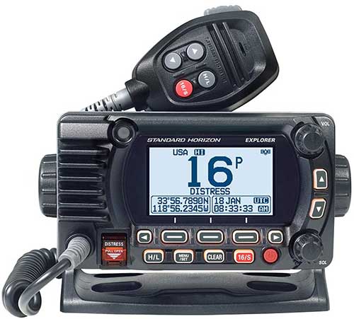
1. Standard Horizon Explorer GPS Fixed Mount Marine Radio
Buy from Amazon
| Built-in GPS |
Yes 66 channel |
| DSC Distress |
Yes. |
| Waterproof |
Submersible IPX8 |
| Color |
Black or White |
| Man over Board |
Yes |
The Standard Horizon GX1800G marine radio stand-out feather is the 66-channel built-in GPS Reciever. This allows for Digital Selective Calling (DSC) distress signals to be sent without wiring the radio into a second device that also has GPS. It also has a second receiver to receive DSC calls. This is a compact radio and is only 3.3 inches in depth. Color options include white or black. It has an IPX8 submersible rating which means it is waterproof at 1.5 meters for 30 minutes.
There is a similar Standard Horizon GX1850G that has NMEA2000 networking that most people will not use. Therefore this lower-cost unit is a better option for most people. The GX1800 without the G is the same unit without the built-in GPS Receiver is cheaper. It is a really good idea to have a radio with a built-in display that shows the coordination all the time. Most captains know how to get the GPS position out of the primary navigation unit and might even display the coordinates on that device. However, in the event of an emergency having multiple ways to get the position immediately is important.
These units are RAM4 compatible, meaning they are capable of being connected to a RAM4 remote microphone. This means that you can have microphones at two different locations on the boat without having two radios. Often times radio calls from inside the cab are missed when outside on the deck. The second handheld microphone also has audio speakers. Navigation features of the unit include Man Overboard MOB operation and enter, save, and navigate to waypoints using the compass.
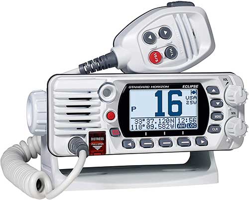
2. Standard Horizon Eclipse Fixed Mount Marine Radio
Buy from Amazon
| Built-in GPS |
Yes 66 channel |
| DSC Distress |
Yes. |
| Waterproof |
Submersible IPX8 |
| Color |
Black or White |
| Man over Board |
No |
The Standard Horizon Eclipse is an ultra-compact class D VHF marine radio with GPS. The waterproof rating is IPX8, which means the radio is submersible in 1.5 meters of water for 30 minutes. Other features include a backlit keypad and a microphone with noise reduction technology.
This is similar to the Standard Horizon Explorer and both are equipped with a built-in GPS receiver. The unit can send a DSC distress signal with the vessel’s MMSI number. This same radio comes in a version without a GPS and is about $45 less expensive. If that unit is properly wired into the navigation unit the GPS position can be obtained to use with a DSC distress call. This is a good quality submersible fixed mount radio and comes with a 3-year waterproof warranty.
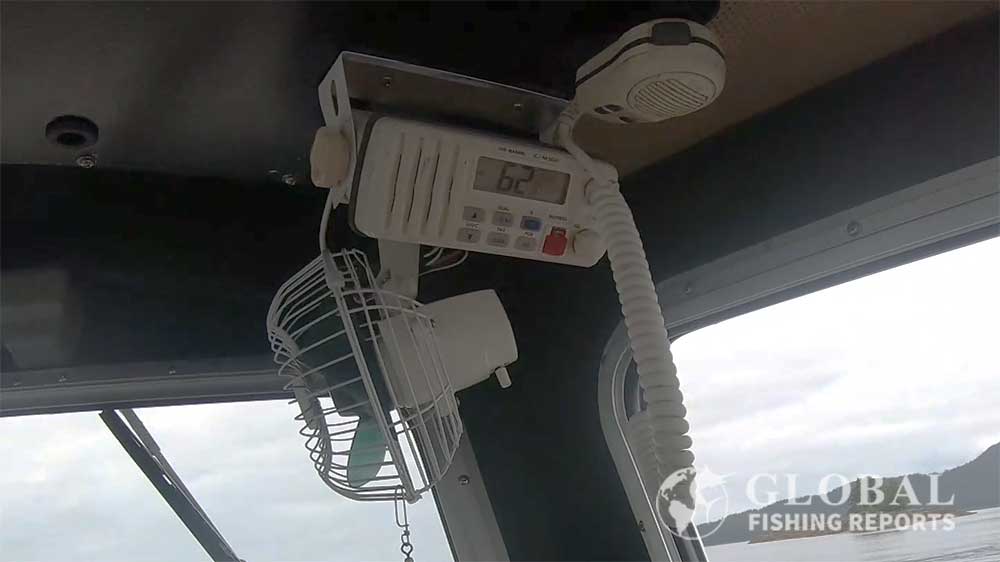
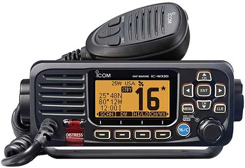
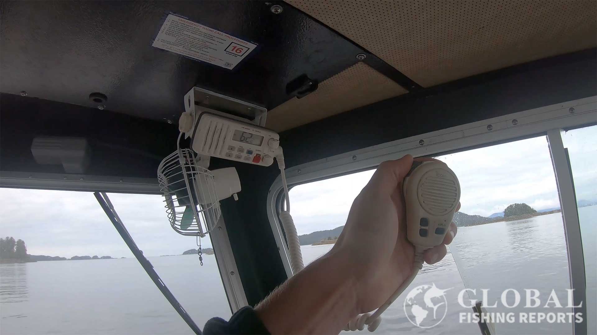
3. Icom-m330g Fixed Mount VHF Marine Radio
Buy from Amazon
| Built-in GPS |
Yes |
| DSC Distress |
Yes |
| Waterproof |
Yes IPX7 |
| Color |
Black or White |
| Man over Board |
No |
The Icom-m330g is a quality fixed mouth VHF radio. It comes with an external GPS antenna which is good when using a radio with an enclosed hardtop boat. The output power of the radio is 25 watts.
Features include a backlit display, backlit keypad, channel and volume buttons on the microphone, and weather channels with weather alerts. A unique feature is the AquaQuake which can be activated to use low-frequency sound waves to remove water in and around the speaker area.
4. Cobra MRF45D Class D Fixed Mount Marine Radio
Buy from Amazon
Shop Bass Pro Shops
| Built-in GPS |
No |
| DSC Distress |
Yes |
| Waterproof |
Yes JIS7 |
| Color |
Black or White |
| Man over Board |
No |
The Cobra radio is very compact when it comes to fixed-mount radios. However, it is not as rugged as other radios but would work well in an inside environment. The waterproof rating for the unit is JIS7 waterproof, which means that it is immersion resistant but not submersible. It does say submersible on the front of the unit but technically that is not correct.
The microphone is exceptional and utilizes noise-canceling technology to ensure your outgoing communications aren’t droned out by the wind or engine noise. It is DSC compatible with the standard one-touch distress button located on the front panel and it will transmit your communications in either 1W or 25W power configurations.
Furthermore, it gets the typical 10 NOAA weather channels with audible storm alerts and the standard international coverage scheme with 3 channel maps. This unit from Cobra utilizes Dual-watch technology that allows you to monitor channel 16 and another channel of your choosing simultaneously.
5. Uniden Fixed Mount Marine Radio
Buy from Amazon
| Built-in GPS |
No |
| DSC Distress |
Yes |
| Waterproof |
Submersible IPX8 |
| Color |
Black or White |
| Man over Board |
No |
This Uniden 435 replaced the very popular Uniden UM415. It has an output power of 25 Watts. It does not have a GPS receiver but it can be wired to a GPS device or GPS antenna.
Available in both black or white, the UM415 is an excellent value in terms of fixed-mounted marine radios. DSC can be set up to send vessel and position information when pressing the distress button.
The water-resistant rating is JIS-8 which means the radio is submersible to a depth of 1-meter for 30 minutes. This radio is capable of both 1W and 25W transmitting configurations. It has a front-facing full class D DSC button protected by a flip cover.
This radio encompasses several great features such as Triple Watch Plus which allows the monitoring of Channel 16 and Channel 9 plus other custom-selected channels. Targeted SAME weather alert system is very convenient and accurate and includes tide reports. The Quik Command One-Touch Ch 16/9 channel selectors on the microphone make switching to emergency channels extremely fast. Additionally, the channels and scan can be selected from the microphone.
The LCD display has a dimmer and adjustable LCD contrast settings. The dimmer is helpful when boating in low-light and night conditions. With some radios, I actually have to place objects over the radio to keep my night vision when driving boats at night.
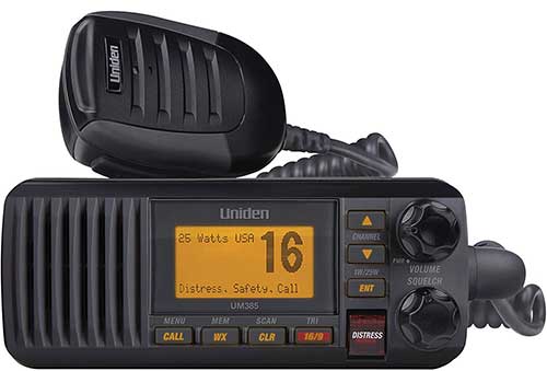
There is a UM385 compact version of this radio that is not submersible and only has a JIS4 splash-resistant rating. This will work if the radio is mounted inside a cabin but should not be used outside.
6. Garmin VHF Marine Radio
| Built-in GPS |
No |
| DSC Distress |
Yes. |
| Waterproof |
Yes IPX7 |
| Color |
Black |
| Man over Board |
No |
The Garmin 110 in a basic VHF radio. There is not a built-in GPS but it can be easily connected to a GPS device or GPS antenna using an NMEA 2000 network cable. It comes with knobs, mounting hardware, a protective cover, a flush mount gasket, and power cables.
There is also a Garmin 210 which has AIS built-in. The AIS information for nearby vessels that have AIS transmitters can be displayed on the chart plotter. AIS can be very useful for people who boat near commercial vessels. If this is not a needed function the Garmin 110 is the better option because it is a lower-cost unit.
7. Lowrance Link-6 DSC Marine VHF Radio
| Built-in GPS |
No |
| DSC Distress |
Yes |
| Waterproof |
Yes IPX7 |
| Color |
Black or White |
| Man over Board |
No |
Lowrance makes two VHF fixed mount Marine Radios the Link-6 and Link-9. The Link-6 does not have a built-in GPS but can be wired to the navigation unit to offer DSC functionality. Key features of the Link-6 include a four-button hand microphone, 16 dedicated channels, multiple scan modes, and flush or bracket mount installation. In the contacts list up to 50 names with MMSI numbers can be stored.
The Lowrance Link-9 comes with a built-in GPS receiver. It can also receive GPS position data from an SMA connector, NMEA-500 for Chartplotter GPS, and NMEA 2000 for the network antenna connection. The build-in AIS receiver information can be displayed on the radio’s screen or overlayed on a multifunction display’s navigation or radar screen. The Link-9 also has a MOB function to navigate back to a person or object in the water.
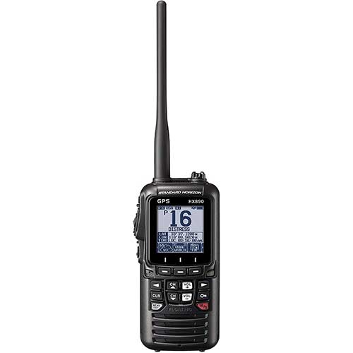
8. Standard Horizon HX890 Submersible Marine Radio
Buy from Amazon
| Built-in GPS |
Yes 66 channel |
| DSC Distress |
Yes |
| Waterproof |
Submersible IPX8 |
| Man over Board |
Yes |
| Weight |
10.94 oz |
| Battery Life |
Up to 11 Hours |
| Floating |
Yes |
The Standard Horizon HX890 is a class D handheld radio that supersedes the old version, the HX851. This radio floats, making it an excellent choice for kayakers and boaters. The waterproof rating is IPX8, which means the radio is submersible in water depths up to 1.5 meters.
This handheld allows you to choose to transmit power levels at 1W, 2W, or 6W, which is incredibly useful for both short to mid-range communications. The rechargeable 1800mAH Li-Ion battery lasts about 10-hours with average use. Many reports agree that it is one of the longest-lasting handheld marine radios on the market. Also included is a 12-Volt DC 3 hour quick charger.
This radio has an automatic water detection module that will, upon being in contact with water, flip on its emergency strobe light function. Having a strobe is very important for day and night rescue situations.
The HX890 is equipped with DSC and features a powerful WAAS GPS receiver with 66 channels. This is all interfaced through the oversized full dot-matrix LCD screen that measures roughly 2.3 inches diagonally. These screens are used for their incredible detail but extremely low cost to battery life.
Some VHF radios have a blue or orange background, which many people seem to enjoy, however, these monochrome screens tend to save a lot of battery so I think it is a fair tradeoff. Although the screen lacks color, the keypad does utilize a faint red illumination to ensure accurate and easy usage in the dark.
Handheld VHF Marine Radios
For small vessels or a quick solution, a handheld VHF radio is a great option. Handheld radios are also great to have as a backup safety piece of equipment in the event of an emergency.
These portable radios look similar to walkie-talkies and are meant to be held in your hand, clipped on your belt, or kept in your bag. Having portability and a small form factor does come at a cost, though. These usually have less range and fewer options than a fixed radio but are especially useful if you plan to use multiple different watercraft.
The video above discusses important information about hand held VHF radios.
9. Standard Horizon HX40 Handheld VHF Marine Radio
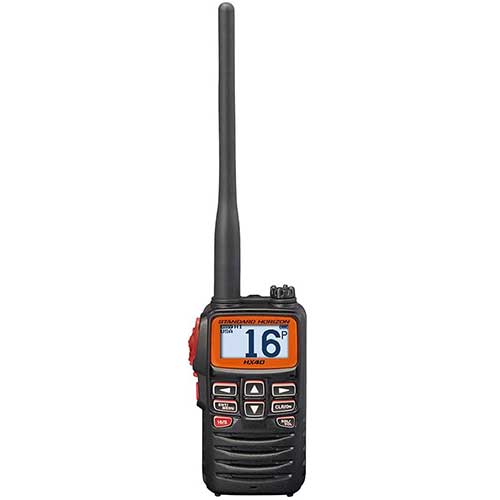
Buy from Amazon
| Built-in GPS |
No |
| DSC Distress |
No |
| Waterproof |
Submersible IPX8 |
| Man over Board |
No |
| Weight |
8.1 oz |
| Battery Life |
Up to 10 Hours |
| Floating |
No |
The Standard Horizon HX40 is a compact floating handheld VHF marine radio. It is 2.5 x 3.74 x 1.3 inches which is about the size of a deck of cards. It does not float unless placed into a floating case that is sold separately.
This radio transmits with 6 watts of power. It is powered by a 7.4 volt Lithium Polymer battery. Key features include a dot matrix display, weather alert, scan, easy-to-use menu, a receiver that can play the FM radio, and a limited three-year warranty.
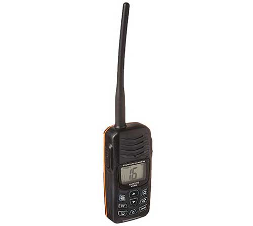
10. Standard Horizon HX300 Submersible Floating Marine Radio
Buy from Amazon
| Built-in GPS |
No |
| DSC Distress |
No |
| Waterproof |
Submersible IPX8 |
| Man over Board |
No |
| Weight |
8.4 oz |
| Battery Life |
Up to 11 Hours |
| Floating |
Yes |
This radio is the smallest floating marine radio on the market. It is small enough to fit in your pocket. Included is a USB charger and cord. The radio can plug into any USB port to charge and receive a full charge in roughly 3 hours. We have talked about a similar model to this, the HX890 floating marine radio which probably has a better overall performance but the size of this radio makes it a great option.
Its transmitting power is capped at 5W, which may seem like a slight disadvantage to the many 6W models on the market. However, the distance a handheld radio will transit is mostly limited by antenna height, not transmission power. It is equipped with a 1650mAH 3.7V Lithium-ion battery that gets about 10 hours of usage.
This unit’s waterproof rating is IPX8, which means the radio is submersible in water depths up to 1.5 meters for 30 minutes. The radio is equipped with NOAA weather channels, and customizable weather alerts, and utilizes all of the traditional US and Canadian channels.
The screen is a very tiny monochrome LCD with orange key illumination built-in. Just like the HX870, this radio does have a water-activated strobe beacon.
I recommend this to anyone on a budget or looking for something extremely small. If you’re venturing out in a large vessel, you should look to a mounted VHF radio or something with more features, like the HX890. If you are taking out a kayak or something similar, this unit will save space but realize that it does not have a built-in GPS to send position information.
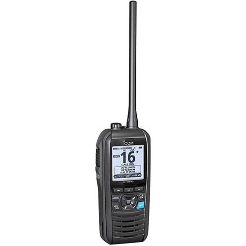
11. Icom M94D VHF Marine Handheld Radio
Buy from Amazon
| Built-in GPS |
Yes |
| DSC Distress |
Yes |
| Waterproof |
Yes IPX7 |
| Man over Board |
Yes |
| Weight |
10.58 oz |
| Battery Life |
Up to 10 Hours |
| Floating |
Yes |
The Icom M94D is a top-of-the-line VHF handheld marine radio. This unit has GPS and other systems to create an integrated Global Navigation Satellite System. The position information can be used to make DSC distress calls and to navigate to waypoints. Key features include float’n flash, AquaQuake, and an active noise-canceling microphone. It has an output transmission power of 6 watts. Float’n flash is nice because if the radio falls into the water it will automatically start flashing even if the radio is off.
This radio comes with a 570mAh rechargeable Li-ion battery, AC adapter, battery charger, belt clip, and hand strap. The unit can store up to 50 waypoints. It has a dot-matrix display that can be read even under direct sunlight. I like this unit cause it serves as a good VHF radio and navigation device. It would also be a good radio to keep on the boat as a backup radio and backup navigation device.
12. Icom IC-M73 Handheld Marine Radio
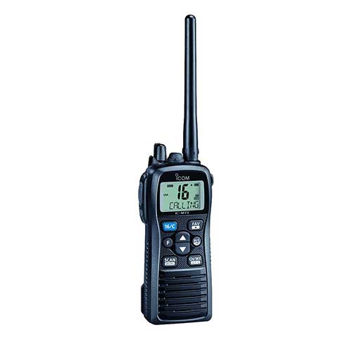
Buy from Amazon
| Built-in GPS |
No |
| DSC Distress |
No |
| Waterproof |
Submersible IPX8 |
| Man over Board |
No |
| Weight |
9.0 oz |
| Battery Life |
Up to 16 Hours |
| Floating |
No |
This radio does not float. However, it is submersible and can be submerged in 1.5m (4.9ft) of water for 30 minutes. Battery life is rated at 18 hours under normal operating conditions. This is longer than most handheld radios! It might not float but it does have a large-capacity lithium-ion battery.
The IC-M73 can be operated at 6W of transmitting power, which is higher than the traditional 5W maximum. That one extra watt doesn’t really seem to help in range, despite the description of the product claiming so, but it does help your audio traffic punch through busy channels and white noise.
This is also the loudest handheld radio. Icom achieves this incredible volume level by using a BTL (bridge-tied load) amplifier, which they claim doubles the audio. Something else that is really nice about this particular radio is the dual/tri-watch function that allows you to monitor several channels, such as channel 16 simultaneously with other channels.
13. Icom M25 Handheld VHF Marine Radio
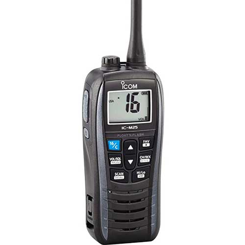
Buy from Amazon
| Built-in GPS |
No |
| DSC Distress |
No |
| Waterproof |
Yes IPX7 |
| Man over Board |
No |
| Weight |
7.8 oz |
| Battery Life |
Up to 11 Hours |
| Floating |
Yes |
The Icom M25 is the lightest floating marine radio on the market. It also has an option HF-231 handheld speaker microphone to make it easy to talk while wearing the radio on a belt. The 1500 mAh lithium-ion battery can be charged through a standard USB connection. It displays the battery life with a 4-step indicator. Color options for the stripes are marine blue, pearl white, and metallic gray.
Key features of the radio are weather channels, weather alert, auto scan, LCD backlight, and AquaQuate the removed water from the speaker when activated. Float’n Flash is activated if the radio is dropped into the water even if the radio is turned off. This turns on the backlight on the radio display and lights a LED that blinks on the rear panel.
14. Uniden MHS75 2-Way Submersible VHF Marine Radio
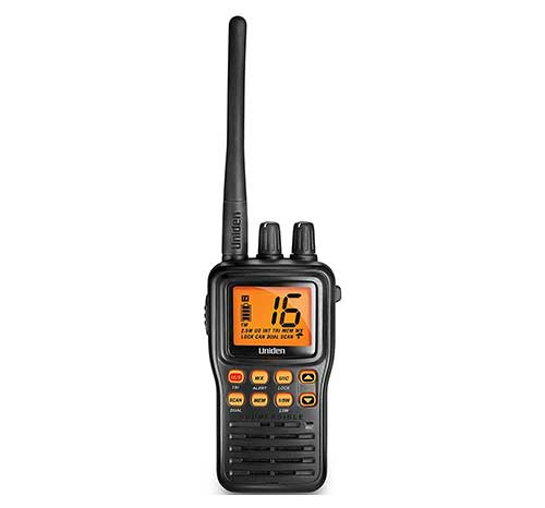
Buy from Amazon
| Built-in GPS |
No |
| DSC Distress |
No |
| Waterproof |
Submersible JIS8 |
| Man over Board |
No |
| Weight |
10.2 oz |
| Battery Life |
Up to 12 Hours |
| Floating |
No |
This radio comes with a JIS8 waterproof rating, which means the radio is submersible for up to 30 minutes at five feet. The unit comes with a belt clip, wrist strap, DC charger, and lithium-ion battery. This radio offers great overall value but does not float.
The maximum transmitting power level is 5W, which as we discussed before is not a big deal. This low-power option of this unit is 2.5W. Using lower power is a good idea when communicating over short distances. It saves battery life and interferes less with other people that might be using the channel in the area.
This radio has the tri-watch feature, which means it will monitor multiple channels including Channel 16 and Channel 9 with another channel of your choosing. This radio is usable on all of the standard American and Canadien channels.
The LCD screen on this unit seems to be a respectable size among VHF radios and is one of the easiest to read in direct sunlight. Just like some of the more expensive radio’s on this list, the MHS75 allows for the standard 10 NOAA weather channels and NOAA weather alerts with very loud audible alarms when the weather changes for the worst.
Battery life is good, coming in at roughly 12 hours on a single charge. The unit comes with a DC cigarette lighter charger and the radio will audibly alert you when the batteries are dangerously low.
This radio offers all the standard features and packs them into a very rugged and compact aluminum shell. The Uniden MHS75 is a great overall handheld marine radio if the radio does not need to float.
15. Uniden Atlantis 155 Floating Marine Radio
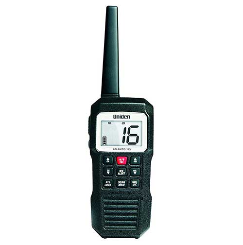
Buy from Amazon
| Built-in GPS |
No |
| DSC Distress |
No |
| Waterproof |
Submersible JIS8 |
| Man over Board |
No |
| Weight |
8.53 oz |
| Battery Life |
Up to 10 Hours. |
| Floating |
Yes |
The Atlantis 155 floats and is submersible with the highest IPX8 / JIS8 rating. The speaker also clears itself of water after being submerged. This radio is powered with 4 rechargeable AAA batteries. Also included is a DC charging cable. This is definitely the best value marine handheld radio that floats and has the highest submersion rating. Also, the ability to use standard AAA makes it a great option for an emergency backup marine radio.
The transmit power is user-selectable to 3W or 1W of power. That is the only drawback to this unit, most handheld marine radios have a standard 5 watts of transmission power. The battery life lasts about ten hours. The unit comes with a 3-year waterproof warranty.
16. Cobra MRHH350FLT Floating VHF Marine Radio
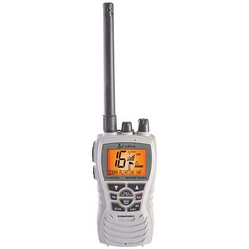
Buy from Amazon
Shop Bass Pro Shops
| Built-in GPS |
No |
| DSC Distress |
No |
| Waterproof |
Yes IPX7 |
| Man over Board |
No |
| Weight |
8 oz |
| Battery Life |
Up to 8-14 Hours |
| Floating |
Yes |
The waterproofing rating is JIS7 / IPX7 which allows safe submersion at 3 feet for up to 30 minutes. Not quite as good as units with an IPX8 rating but still very waterproof.
The power transmission levels available are 1, 3, and 6W which is on par with some of the best handheld devices on the market today and will safely cover at least 3 miles with ease. It comes equipped with a tri-watch, which essentially means it will scan three different channels simultaneously.
You will get the typical 10 NOAA weather channels in addition to all of the standard US and Canadian channels. If there is a severe weather alert, this device will play a loud tone alerting you to possible dangerous changes in the weather.
This radio utilizes a noise-canceling microphone and water purging speaker to ensure excellent audio quality, even when floating in the water.
17. Cobra Electronics MR HH150 Floating Marine Radio
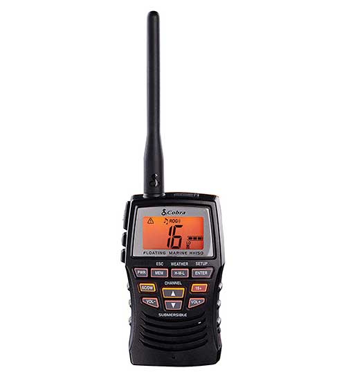
Buy from Amazon
Shop Bass Pro Shops
| Built-in GPS |
No |
| DSC Distress |
No |
| Waterproof |
Yes JIS7 |
| Man over Board |
No |
| Weight |
8.0 oz |
| Battery Life |
N/A |
| Floating |
Yes |
This Radio uses rechargeable AAA batteries which are included. Standard AAA batteries also work with this radio so if the radio is dead in an emergency it can be repowered quickly. The HH150 has a waterproof rating of rated JIS7 which is submerged in up to 3 feet of water for 30 minutes. This unit weighs 8 ounces and does float!
Also included with this radio is a belt clip, wrist strap, and 12-volt power cord. The radio has a max transmission power or 3 Watts but can be sent at low, medium, and high output power for short and medium-range communications. As with most marine radios, weather alerts are given with tones and visual alerts. NOAA weather can be access on 10 NOAA weather channels.
Why Every Boat Should Have a Marine Radio
Marine radios give us the ability to communicate with the Coast Guard and also other vessels if needed. Even in non-emergency situations the Coast Guard or other boats may contact try and contact you. This can be for a large variety of reasons. Sometimes they need help, sometimes they want to give vessels in the area information. Sometimes you are making a wake in the harbor and they want to remind you to slow down.
The most important reason for having a radio is to call for help and be able to help others that call for help. It is not always a life-threatening emergency but other boats in the area can often offer assistance. If you spend lots of time on the water you realize these situations happen quite often. Offshore cell phones do not get reception and VHF radios become a primary means of communication.
Using a marine radio is also handy in communicating with harbors, docks, locks, bridges, marinas, etc. If you’re sailing international waters, you’ll need a radio to communicate with the local coast guard and law enforcement.
Also, most marine radios are fully capable of receiving weather broadcast reports when/if they are in the range of an entity broadcasting such information. These reports can also provide vital warnings such as natural disasters or conflicts.
Other Ways To Communicate or Contact Help
In the event of an emergency, another good way to contact help is with a Personal Locator Beacon or with an EPIRB. These devices are typically used to send distress signals only. It is a good idea to have one of these devices on the boat in addition to a VHF marine radio.
Marine Radios Explained
A marine radio is classified as a Very High Frequency (VHF) radio. Essentially this means it has access to an all-inclusive radio frequency band between 156MHz and 174MHz. This range of frequencies is regarded as the maritime mobile band. The same rules apply anywhere you are in the world.
How to Utilize Marine Radio Technology
VHF radios operate on an international standard and have very distinct rules and regulations as to how they are used in communication. Channel 16 (156.8 MHz) is the international distress and communications channel.
Channel 16 can be used in a wide variety of applications. This includes establishing a baseline of communication that then moves to a more private channel. For the most part, channel 16 is used for urgent communication in which one or more parties are in distress. Assistance can be then be provided by the Coast Guard and/or nearby vessels.
International regulations require all vessels to achieve a constant state of “radio watchkeeping”. This essentially means they are open to communication and monitor channel 16 at all times while sailing. It is standard to move communication off of channel 16 as soon as possible, most likely within the initial point of communication. This leaves the channel clear for other users who may also be in distress.
Sending a Distress Signal with a VHF Marine Radio
When an emergency arises that is life-threatening, you have two options in order to ask for help from other vessels and the Coast Guard. First, if you have a DSC-enabled radio on hand, activating the automatic distress transmission system would be the first thing you can do.
If you receive no response or do not have a DSC-enabled device, using Channel 16 to broadcast your distress is your best option. The proper procedure for broadcasting such an event on Channel 16 is as follows: Call out “Mayday” three times followed by your ship’s name, your coordinates, and the issue at hand.
A distress signal would sound like this: “Mayday Mayday Mayday, Seastar. Position 20°35′ North and 77°51′ West. Our vessel is sinking”. This entire message can be repeated three times. If someone is severely injured, including brief information about the injury may help rescuers be prepared for treatment once they arrive. Furthermore, including information about how many people are on board may also be imperative to rescue efforts, especially if people are overboard or the vessel is sinking as it will allow the responding crews to continue searching for people until they find everyone.
When a distress signal is sent via DSC, the device will include the ship’s MMSI number and attempt to include coordinates and other GPS information if possible. You have to connect your GPS and DSC devices and set them up accordingly for your DSC instruction manual to automatically broadcast this information. Distress signals can be sent in both single-frequency and multi-frequency configurations.
Distress Signals Types
A single-frequency distress signal is issued across a single band. The system will then await a response for a maximum of four minutes before issuing another distress signal. This will be repeated five times until switching to a multi-frequency configuration.
A multi-frequency distress signal is sent on all medium and high frequencies in an attempt to receive any and all responses. You will be unable to receive transmission while attempting a multi-frequency distress signal. This is because it uses your return antenna for each transmission.
Distress signals can come in both a specific designation and a general or non-designated transmission. A designated distress signal will send out information pertaining to one of ten pre-defined groupings with the aim of identifying the source of distress.
Designated distress signals are as follows: Man overboard, violent incursion and/or piracy, vessel disabled, punctured or sinking, listing, fire or explosion, flooding, collision, grounding, and abandoning ship.
A vessel that receives a distress signal that is outside the range of a coast station is required to relay the distress alert to the utmost level of their capabilities. When a coast station receives a DSC distress alert, the station will immediately send an acknowledgment. The sending unit will both cease repeating and tune in on the designated channel for the distress message to be sent.
Digital Selective Calling (DSC)
Seagoing vessels that utilize a permanently mounted radio are now required by international regulation to be equipped with Digital Selective Calling (DSC). DSC can be utilized across medium or high-frequency channels and is a core integration of the Global Maritime Distress Safety Program (GMDSS). All fixed-mount VHF radios manufactured since 1999 come with DSC.
DSC greatly enhances the safety features of a marine radio by allowing a single push button distress signal to be sent out immediately. The signal contains vital information for emergency response units to track, locate, and communicate with the vessel in need.
Many ships equipped with DSC use a separate VHF radio and MF/HF DSC controllers that allow a dedicated receiver to monitor Channel 70. This way, your primary receiver is always in use for regular communications while your DSC dedicated receiver is always monitoring and ready to call for help.
Maritime Mobile Service Identity Number (MMSI)
The Maritime Mobile Service Identity (MMSI) number is a 9-digit number unique to your vessel that is assigned to your radio DSC system. Information about you and your vessel is added to a profile that the Coast Guard can easily access in case of an emergency. This greatly increases the effectiveness of help during distress.
You can register for your personal MMSI through various boating organizations for approximately $25.
Setting Squelch
A telecommunications squelch is essentially a noise gate that regulates and suppresses what your radio will and will not pick up. This ensures the radio remains silent and usable when not receiving an actual transmission, effectively reducing channel noise.
An open channel without suppression will create a white noise type transmission that is constant and unnecessary, not to mention annoying and distracting.
To properly set squelch, turn the SQL knob until you faintly hear a white noise sound, then back it off ever so slightly. Setting your squelch too low may result in the lower performance of the receiver. This means transmissions from far away may not be picked up on your radio.
False Mayday Calls
Yes, using a marine radio to call out a false distress signal is illegal and punishable by up to six years imprisonment. Possible fines are up to $5000 in civil court and $250,000 in criminal court. Simply put, do not call for help unless your distress is legitimate.
On top of all of that, you may be required to reimburse the Coast Guard for the time and assets used to respond to your false call.
VHF Marine Radio Etiquette
Using a VHF radio comes with a certain level of responsibility and communicative skill set. Keeping messages short but informational is actually much more difficult than most people realize. Oversharing details on vital channels not only bugs other nearby vessels but could impede their ability to communicate and even issue a distress signal.
The proper way to address a vessel is by beginning the transmission on channel 16 (when there is no other radio chatter) with the name of the boat you wish to communicate with followed by your boat name like this: “Seastar Seastar. Galileo. Over”.
To respond: “Galileo, this is Seastar”. Proper radio etiquette mandates that you only retry your acknowledgment after a full two minutes have passed with no response. Furthermore, you are permitted a maximum of three attempts to get the vessel’s attention with the 2-minute intervals. After that, you should wait a minimum of 15 minutes before making another attempt.
Once the vessel responds, a channel designation should be given in an attempt to move from channel 16 to a non-commercial ship-to-ship communication channel. These are channels 68, 69, 71, 72, and 78A. It may be tempting to call these out as “Sixty-eight”. However, it is actually proper to communicate them as each number individually, like “six-eight” to avoid confusion.
Once you have tuned in to the communication channel, you would once again acknowledge the other vessel to ensure you’re both on the correct channel and then commence with your conversation.
VHF Radio Conversations
Remember, anyone with a VHF radio within range can follow your communication and listen in on your conversation. Keep it clean and respectful and be mindful of the details you share.
Always ending your conversation in “out” allows anyone else awaiting the use of that channel the opportunity to essentially claim it for their communication purposes.
If leaving channel 16 lands you on a communication channel already occupied by other vessels communicating. The options are to wait for the “out” signal of the vessels occupying that channel. Resorting back to channel 16 and designating another communication channel is the second option.
Never attempt to communicate other than to “call” another vessel or send a distress signal on channel 16. Channel 9 is an alternative channel to channel 16 designated for calling.
Technically, profanity over the air is illegal so watch your language. If you can’t say it in a high school classroom, you can’t say it on a VHF radio. Even if you think you and the vessel you are communicating with think you are on a channel alone.
VHF Marine Radio Transmission Power and Antennas
Choosing a power level is basically related to how far your transmissions need to travel. If you’re communicating with a vessel that is nearby, perhaps only 1 watt is necessary. This ensures that your communications are not broadcasted far out into the sea where other vessels will unnecessarily hear them. If you’re making a distress call, you’d likely want to use the maximum power output of your device to reach as many vessels as possible.
Keep in mind that the quality and height of the antenna will be the number one attribute of an effective range. The further your antenna can “see”, the more range your radio will have regardless of the wattage it is set to.
Higher power levels may help your radio transmission navigate radio noise and impede traffic.
For a typical adult standing on the deck of the boat, the viewable distance to the horizon is roughly three miles. Since VHF radios work based on a line of sight and fail to transmit to receivers without a line of sight, three miles will likely be your limit unless you have a tall antenna perched up high aboard your vessel. The higher the antenna, the further out it is capable of reaching.
VHF Marine Radio Antenna Size and Placement
For antennas a general rule of thumb is the taller the antenna, the more coverage you will have. The advantage of a fixed mount VHF radio is a tall antenna. Handheld radios work well but cannot match the range of a fixed mount radio with a good antenna.
VHF radios can only emit a 25-watt signal. However, large antennas that can be vertically mounted can have a large gain on the received signal. This makes it so signals can be picked up clearly at greater distances. High gain antennas must stay vertical though. Since this is often not the case on boats that sway in the waves, a medium gain or low gain antenna is a good option. Handheld radios are low gain so the direction of the antenna is less important.
Some people like to mount their antennas at an angle. This is called a “canted mount” or “raked mount”. This is also called a silly waste of a potential performance. Why? Because the higher your antenna, the better its performance, period.
The higher in elevation the end of the antenna that sticks up into the air and allows for more oversight into the distance, the better your range will be. A canted antenna will only have the performance of how tall it is from the surface of the water. This is independent of how long the actual antenna is. Straight up and down is the best way to mount an antenna. If you really want to squeeze every ounce of range out of it, you’ll mount it on the highest point of your boat.
Check out the Coast Guard website for VHF coverage maps in your area.
Common Questions about VHF Radios
Do I need a VHF radio for my boat?
Recreational vessels under 20 meters in length are not required to have VHF marine radio in many areas. That being said almost all boats that travel offshore have a VHF marine radio. This is an important communication tool to talk with other boaters in the area. This allows fishermen to say how their day is going. It is also commonly used to give wind, wave, and weather reports in nearby areas. Even vessels as small as a kayak should have handheld marine radio with them when on the ocean.
What channel should I monitor while boating?
Always monitor Channel 16, which is the international distress and calling channel. Once you establish contact with another vessel, move to a working channel for extended conversations.
How far can VHF marine radios transmit?
The range depends primarily on antenna height and power output. Fixed Mount radios with properly installed antennas can typically reach 15-20 miles, while handheld units may be limited to 3-5 miles under ideal conditions.
Do I need a license to operate a marine VHF radio?
In the United States, recreational boaters do not need a license to operate a VHF marine radio on domestic voyages. However, if you travel internationally, you may need a restricted radiotelephone operator permit.
How do I get an MMSI number for my VHF radio?
You can obtain an MMSI number through various boating organizations or through the FCC if your vessel requires a station license. The process typically costs around $25 and requires information about you and your vessel.
Captain Cody has worked on charter fishing boats in the Florida Keys, Virgin Islands, and Alaska. Growing up in Pennsylvania Cody has also done extensive freshwater fishing including bass fishing tournaments. Cody strives to provide detailed information about the best fishing gear and tactics to help both novice and experienced anglers have a more productive and enjoyable time on the water. Cody also has a background in aerospace engineering and neuroscience but really only takes pride in being good at one thing and that is fishing!
Types of Personal Locator Beacons (PLBs), Satellite Messengers, AIS and DSC
Personal Locator Beacons (PLBs) emit a distress signal in the event of an emergency offshore or on land. PLBs are generally thought of as small handheld Emergency Position Indication Radio Beacons EPIRBs. The main difference between the two is that an EPIRB is registered to a vessel and PLB is registered to a person. A PLB is a small device that has to be manually activated and can emit a distress signal for a minimum of 24 hours. EPIRBs are larger, can automatically deploy and activate if a boat sinks, and emit a distress signal for a minimum of 48 hours.
People have started to call devices with other handheld GPS technologies PLBs as well. These devices are also registered to a person and can send a distress signal in an emergency. These devices include Garmin inReach units, Spot satellite messengers, AIS man overboard beacons, and VHF handheld Marine Radios with DSC (Digital Selective Calling). Some of these technologies require monthly fees, and some do not require monthly fees.
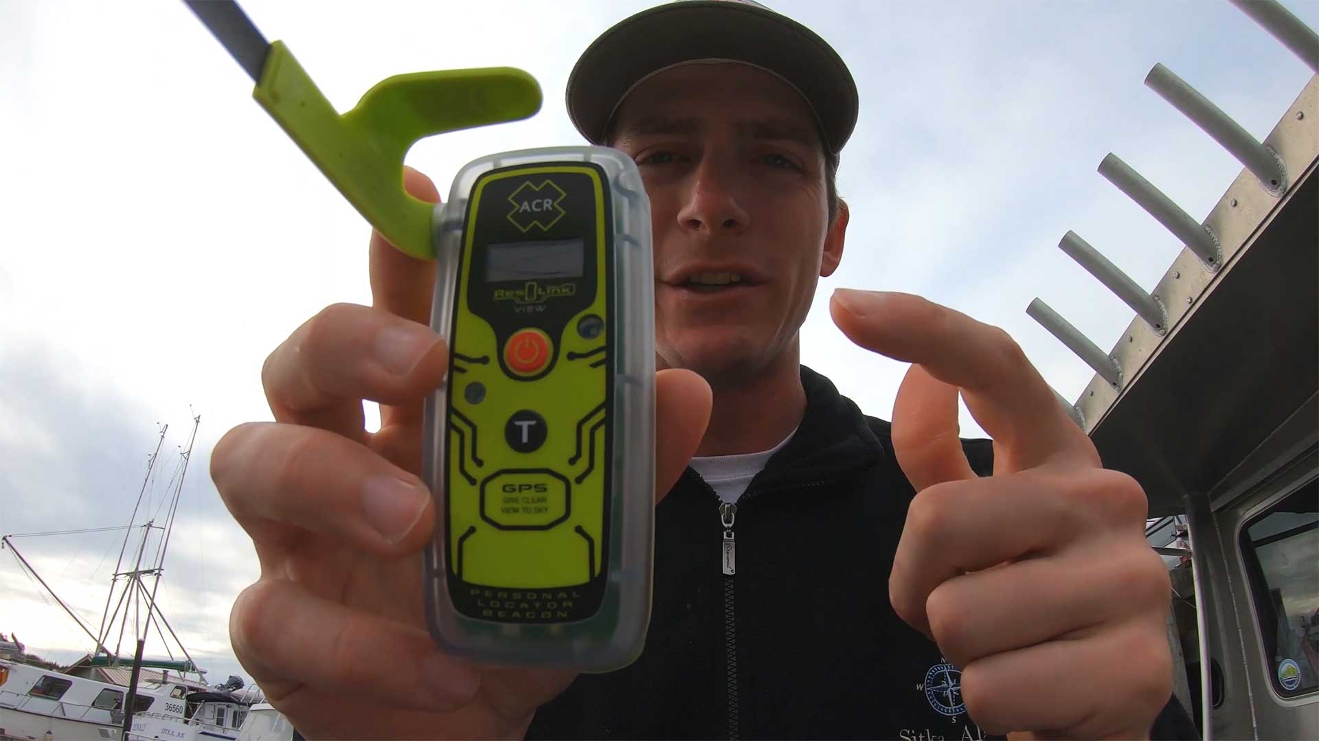
For boating and fishing, I recommend having a PLB that emits a 406 MHz distress signal using satellites and a 121.5 MHz homing signal. This type of beacon is registered with NOAA and does not require any subscription fees. The distress signals are monitored by government organizations around the world.
In the photo, my brother and I are fishing in Florida. He is wearing a PLB on his life jacket. In this case, it is placed through the strap of the life jacket. PLBs also fit well in zipper pouches on life jackets. Wearing a PLB is ideal because in the event a person falls overboard, help can be quickly contacted. This is a must-have device when fishing on a boat offshore.
Types of Personal Locator Beacons
1. Satellite PLBs (406 MHz Beacons)
These are the traditional PLBs that operate on the 406 MHz frequency and connect to the international COSPAS-SARSAT satellite system. They are registered to individuals (not vessels) and require manual activation.
Key features of 406 MHz PLBs:
- No subscription fees
- Globally monitored by government rescue organizations
- Battery life is typically certified for 5 years
- Operational time of at least 24 hours once activated
- Have GPS for precise location reporting
- Include 121.5 MHz homing signals to help rescuers locate you
- PLBs are waterproof and some float
- Registration with NOAA is required but this is free
The 406 MHz distress signal contains the device location within 100 meters and the serial number of the PLB. The ground station is able to look up who that device belongs to and try to contact the registered person and their emergency contacts to verify the emergency. Typically rescue crews can be contacted and be on the way to assist people within 30 minutes from the initial distress call. EPIRB and PLB rescue beacons have been used in over 30,000 rescues.
ACR PLB 425 View ResQLink Buoyant Rescue Beacon
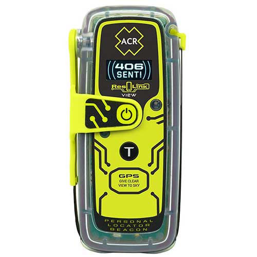
Buy from Amazon
Shop Bass Pro Shops
The ACR ResQLink View RLS is the latest model by ACR and is the best PLB on the market in my opinion. The newest feature is the RLS (Return Link Service), which displays on the screen that the distress signal has been received. It does cost a bit more for this added feature. The ResQLink 425 view is similar but without this new feature, and the ResQLink 400 does not have a display but does flash lights to show it is working.
This beacon emits a 5 Watt 406 MHz distress signal and a 50 mW 121.5 MHz homing signal. This unit contains a built-in display that provides the status of the signal and GPS coordinates during an emergency. When testing the unit the display is also helpful.
The battery life is 28 hours and is certified for 5 years. This PLB is waterproof at 33 feet for ten minutes. Its dimensions are 4.25 x 2.03 x 1.49 inches and the weight is 5.22 ounces. There are loops on the PLB so the device can be put on straps of a life jacket.
This beacon is the smallest floating PLB on the market. The rescueMe PLB 1 is considerably smaller but does not float. Registration of the beacon is free and there are no added expenses after the initial purchase except a factory replacement of the battery every 5 years.
We typically just buy a new unit every few years and keep the old units on the boat as back-ups. Typically, a better, smaller unit comes out every 5 years anyway. The ACR PLBs have a track record of being reliable and are small enough to easily wear on a life jacket. Even if you are not wearing the life jacket at all times, having these on a life jacket in an open area makes it much more accessible in the event of an emergency.
In the video above I show how to use a PLB in the event of an emergency. I also discuss competing technologies such as Garmin inReach, Spot, and AIS systems. How to test the unit to verify it is working properly is also presented.
Coast Guard Inspected Vessels that carry more than 6 people and are licensed to go more than 3 miles offshore are required to have a category 1 EPIRB. Recreational boats and most charter fishing boats are not required to have an EPIRB or PLB. It is however very important to have at least one rescue beacon on the boat. Ideally, the boat would have a category 1 EPIRB and a PLB for each person on board.
ACR PLB 400 ResQLink Buoyant Rescue Beacon
Buy from Amazon
Shop Bass Pro Shops
This PLB 400 is very similar to the PLB View above but does not have a built-in digital display. The battery life is a minimum of 24 hours compared to 28 hours for the PLB View. Dimensions and weight are the same for both units at 4.25 x 2.03 x 1.49 inches and the weight is 5.22 ounces. The battery is certified for 5 years. This PLB is waterproof at 33 feet for ten minutes.
The unit is the new version of the widely used ACR PLB 375 that is no longer being manufactured. An IR and visible light strobe are built into the front of the unit. This help rescue crews find the device location once at a viewable distance.
The device and sends a 5 Watt 406 MHz distress signal and a 50 mW 121.5 MHz homing signals for 24 hours. The homing signals allow avionics equipment in a rescue helicopter to know the direction of the signal. Rescue crews can then head straight in that direction. Once the signal flips it means they passed the location. At that point, crews begin to look for people in distress. Having a strobe or flare helps in low light and adverse weather conditions.
Two clips come with the device. One is a belt clip that allows the PLB to be worn on the waistband or clipped on a pocket. The second clip has a clamp that can be connected to the inflator tube on lifejackets. Placing the PLB in a zipper pouch of a life jacket is a great way to wear the device.
In the video above a center counsel boat sinks in rough seas at an inlet. Watch how fast the boat capsizes and sinks. There would be little or no time to get rescue equipment. That is why it is important to be wearing a life jacket with a PLB in the pocket. I will go over other reasons to have a PLB later in this article.
Ocean Signal PLB RescueMe
Buy from Amazon
Shop Bass Pro Shops
This ocean signal rescueMe PLB has Dimensions of 1.3 x 2.0 x 3.0 inches and the weight is 4.1 ounces. The battery life is a minimum of 24 hours when in use and the storage life is 7 years. This PLB is waterproof to 49 feet deep. The device emits a 5.0 Watt 406 MHz signal with GPS coordinates and a 25-100 mW 121.5 MHz homing signal.
This PLB has a 66 channel GPS receiver and operates on the Global Cospas Sarsat rescue system. This has similar functionality and specifications to the ACR PLBs. The advantage of this device is that it is the smallest PLB in the world. This makes it easier to contentiously have on your person while on a boat. The PLB does not float on its own but has a flotation pouch to fit the PLB into which enables it to float. This seems like a great option for PLB.
I think the ACR PLB is a better overall device but the size of this one makes it a good option. These devices are only useful if you have them with you during an emergency. The small size of this device makes it so it can be easily carried without causing any major inconveniences.
The black knob makes it so the antenna can be easily pulled out to deploy. The gray knob on top can be hand-wound to contract the antenna back into the case. A spring-loaded flap covers the activation button preventing inadvertent use.
In the video below a boat capsizes after hitting something while boating in the ocean. An ACR PLB was used to send a distress signal. A Cost Guard helicopter crew came to assist the boat. It is interesting to watch the Coast Guards response. Both the Coast Guard and people in distress did a great job.
2. EPIRBs (Emergency Position Indicating Radio Beacons)
While technically not PLBs (as they’re registered to vessels rather than individuals), EPIRBs serve a similar function but with important differences:
- Registered to vessels instead of people
- Can automatically deploy and activate if a boat sinks
- Minimum operation time of 48 hours (versus 24 for PLBs)
- Typically larger than PLBs
- Often mounted in brackets with hydrostatic release mechanisms
Coast Guard Inspected Vessels that carry more than 6 people and are licensed to go more than 3 miles offshore are required to have a category 1 EPIRB. Recreational boats and most charter fishing boats are not required to have an EPIRB or PLB. It is however very important to have at least one rescue beacon on the boat. Ideally, the boat would have a category 1 EPIRB and a PLB for each person on board.
ACR GLOBALFIX V6 GPS EPIRB
Buy from Amazon
Shop Bass Pro Shops
The ACR GlobalFIX V4 is a category 1 EPIRB. This device has the same technology as the PLBs above but can automatically deploy and activate if a boat sinks. Also, the minimum operation time of the battery is 48 hours. The battery is user-replaceable and has a 10-year self-life.
Its dimensions are 4.3 x 8.1 inches and the weight of the beacon is 1 pound 11 ounces. Distress signals are a 5 Watt 406 MHz GPS signal and a 50 mW 121.5 MHz homing signal. This is registered to a vessel and not a person. However, I included it in this list for completeness. A person can easily manually activate this device just like PLB in the event of an emergency.
This EPIRB comes with a category 1 bracket that helps protect the device from the environment. The bracket has a hydrostatic release that deploys the device if it sinks to a depth of 4.9 to 13.1 feet. Once in the water, it floats to the surface and automatically activates. A water detection sensor is what activates the device. The device will activate any time it enters the water unless it is still in the bracket. Taking the device out of the bracket and holding the red button for one second activates the EPIRB manually.
Having a device that automatically deploys is important in the event of a boat crashing or flipping in rough seas. Many people do not keep a PLB on them at all times and some accidents happen too fast to get to rescue equipment. A category once EPIRB is not a full-proof plan either because the device can get trapped or not properly deploy. In a situation where people fall overboard wearing a PLB will be helpful and having an EPIRB on the boat will not be helpful.
3. Satellite Messengers
These devices use private satellite networks to provide emergency alert capabilities plus two-way messaging. Popular brands include Garmin inReach and SPOT devices. These typically use the Iridium or Globalstar satellite networks.
Key features of satellite messengers:
- Require subscription plans
- Provide two-way text messaging capability
- Offer tracking features
- Can send custom messages to friends/family
- Allow communication with rescue personnel during emergencies
- Often include navigation features and weather forecasts
- Battery life varies based on usage patterns and settings
Unlike 406 MHz PLBs, these devices:
- Require monthly subscription fees
- Use rechargeable batteries
- Can be used for non-emergency communications
- Often have more features but potentially less reliability in dire emergencies
Garmin Marine 86SCI Floating Handheld
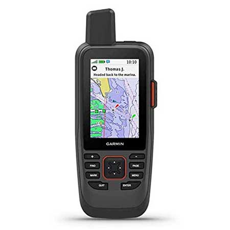
Buy from Amazon
Shop Bass Pro Shops
This Garmin Marine 86Sci is a buoyant two-way satellite messaging device. A subscription fee is required. Dimensions are 7 x 2.74 x 1.7 inches and it weighs 9.59 ounces. The rechargeable battery life varies based on the setting but is around 35 hours in a 10-minute tracking mode and 200 hours in expedition mode. This device has an IPX7 rating which means it is suitable for splashes, rain, snow, and showering but not being submerged in water. Measured diagonally the size of the display is 3 inches. A powered mount and mounting hardware come included.
Specific features of the Garmin 86Sci make it well suited for a marine environment. The large profile allows the device to float. Preloaded G3 coastal charts provided detailed depth counters using both Garmin and Navionics data. Garmin One Chart and new chart guarantee have to be purchased separately if desired. Carts that come with the device should work for most people. Lastly, the device is compatible to work with other Garmin chart plotters and instruments. Although this a good device to have in a marine environment it is not a good replacement for a 406 MHz PLB. One of several reasons is that the battery on the Garmin could be zero and not work in an emergency. Having a dedicated battery with a five-year shelf life is an important feature for an emergency rescue beacon.
There are three other versions in the Garmin 86 series. The differences are that the 86i is compatible with but does not include the G3 charts. Garmin 86s and 86sc do not have two-way satellite messaging and do not have the SOS distress feature. There may be other small differences as well.
Garmin Marine GPSMaps
Blue chart G3 is the latest marine chart for handheld devices. Depth shading can be user-defined for up to 10 depth ranges. Counter lines can be set as small a 1 foot. These are map features we have come to love on fixed mount navigation displays on boats. The handheld unit works as a great back navigation source when traveling in shallow unmarked waterways. With the fixed mount and proper wiring, it can even work as a small primary navigation unit.
Garmin Network Connections
The Garmin 86Sci can interface with Garmin chart plotters and instruments. It can even work as a remote control for the Garmin autopilot and Fusion Marine products. Real-time boat data can be displayed on the unit’s screen. An additional app does need to be downloaded to the device for the autopilot feature. Notifications can be sent from a compatible smartphone to the device. Updates can be pushed to the device over BLUETOOTH. When synced with Garmin Explore management can be done of waypoints and tracks. The autopilot feature can be a nice way to control the boat when on the front or back deck and not immediately near the controls.
Features Available for All Garmin Handheld Units
Garmin Two Way Satellite Messaging
Custom text messages are a nice way to communicate with friends and family. In non-emergency situations, a friend can be contacted without involving emergency rescue crews. Tracking allows friends and family to track the user’s location and find them in the event the user is unconscious and can not send a distress signal. Satellite text message services are a great alternative to expensive satellite phones.
Garmin devices use the private Iridium satellite network that includes 66 low earth operating satellites and has 9 in-orbit spares. This offers decent global coverage for these devices. Messages are not sent instantly and coverage can be blocked by heavy canopies, trees, steep terrain, and valleys.
Garmin SOS Distress Signal
The SOS button on this device is behind a plastic cover so the button is not accidentally pushed. In an emergency, once the button is pushed it sends a distress message with the device location to a ground station. When possible the nature of the emergency should also be sent after the initial distress signal. The emergency services can also respond back with updates and advice for your situation. This is an advantage over 406 PLB where emergency control stations do not have a way to respond back to the user. However, since 406 PLB and EPIRB devices are only to be used in life and death situations the distress signal is taken seriously and help is typically sent ASAP.
Garmin handheld devices do not send a 121.5 MHz homing signal. This band frequency had historically been used by satellites to triangulate the position of a beacon. This signal is not used by satellites anymore but is used by avionics equipment in helicopters to quickly locate the beacon that emits the signal. This is one disadvantage of a Garmin device compared to 406 style beacons during rescue situations.
Garmin Weather Reports
Garmin devices also have basic and premium weather report options. The basic report is a 48-hour report broken down in 2-hour increments for day one and 6-hour increments for day 2. Premium forecasts provide a 7-day report in 1-2 hour intervals for the first day, 3-6 hour intervals for day two, and then 12-hour intervals.
Premium forecasts also have a Marine option. These include a 7-day forecast in 4-hour intervals. The wind direction, wind magnitude, wave height, ocean current, and visibility details are provided for the selected location. Premium weather reports cost $1 per report. Standard weather reports cost 1 text message against your plan. Weather reports are very nice when boating. However, most of them can be found free using VHF radio weather channels.
Garmin Handheld Tracking
Tracking intervals can be set at low 2 minutes with the expedition subscription and 10 minutes with the basic subscription. A 4-hour interval is the longest interval but tracking can also be turned off to save battery. There is a power save mode that does not send the signal if the device has not traveled more than 100 meters in 4 hours.
Garmin has a computer interface the displays the tracking information on a detailed map. When messages are sent the text can also be read with the map interface. This allows family, friends, or a company to track the location of the device. It also allows you to go back later and see where you traveled.
Garmin Handheld Subscription Costs
An annual safety Garmin subscription cost varies from $11.5 dollars per month which include 10 text messages and costs 50 cents for each text message after that. The annual expedition plan costs $65 dollars per month and includes unlimited text messaging and two-minute tracking intervals. The only additional cost would be for premium weather reports. Annually the subscription cost varies from around $144 to $600. Freedom monthly subscription plans without annual contracts are also available at higher monthly costs.
The tracking interval on the plans is 10 minutes or greater or 2 minutes or greater. In most cases, people are not going to want to track users in time intervals of less than 10 minutes. The main problem with short tracking intervals is that it uses the battery much faster. Therefore the tracking interval is not a major deciding factor when selecting plans.
Garmin InReach Mini 2
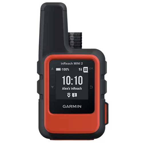
Buy from Amazon
Shop Bass Pro Shops
The Garmin inReach Mini 2 is able the send two-way text messages and interactive SOS messages using the Iridium satellite network. Monthly subscription fees are required. The device is 4 x 2 x 1 inches and weighs 3.5 ounces. Battery life varies based on the settings but is around 50 hours in a 10-minute tracking mode. The device is less than half the weight of the other inReach devices but the battery life is also less than half. This device has an IPX7 rating which means it is suitable for splashes, rain, snow, and showering but not being submerged in water.
Many features of the inReach Explorer+ are also available on inReach Mini. Basic and premium weather can be sent to the device upon request for a fee as discussed in the Explorer review. GPS based tracking intervals let you share your location with friends and family. The position is sent at a preset time interval or when a text message is sent. Preset messages are free for all subscription levels and when sent will also show the device location. This is a way to build a track history without having a set interval selected. This can significantly save battery life because if a message does not send when tracking is enabled the device continuously tries to send the message which can drain the battery quickly. Charging the device is done via the micro USB power cable or optional in-vehicle 12-V charger.
Garmin GPSMAP 66i GPS Handheld
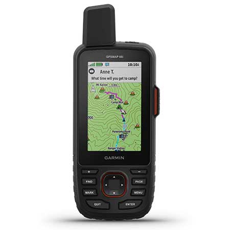
Buy from Amazon
Shop Bass Pro Shops
This Garmin Marine 66i is a two-way satellite messaging device. A subscription fee is required. Dimensions are 6.4 x 2.6 x 1.4 inches and weigh 8.5 ounces. The rechargeable battery life varies based on the settings but is around 35 hours in a 10-minute tracking mode and 200 hours in at 30-minute tracking intervals. This device has an IPX7 rating which means it is suitable for splashes, rain, snow, and showering but not being submerged in water. The display is 3 inches measured horizontally. A powered mount and mounting hardware come included.
This is basically the same unit as the marine 86Sci reviewed above but has a smaller profile so it does not float. Preloaded TOPO maps come installed on the device rather than Marine charts. It also does not interface with other Garmin marine products.
Sensors in the device include a barometric altimeter and a 3-axis tilt-compensated compass. The device can also be paired with a mobile phone to access all the device features and send messages with your phone’s keyboard and contacts. This makes messaging a much faster process.
Garmin InReach Explorer+
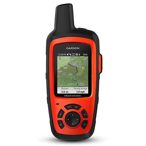
Buy from Amazon
This inReach Explorer+ had dimensions of 1.5 x 2.7 x 6.5 inches and weighs 7.5 ounces. The display size is 1.4 x 1.9 inches. It has a rechargeable lithium-ion battery that lasts 75 hours at 10-minute tracking intervals and 30 days at 30-minute tracking intervals. The SOS button sends distress signals to a private GOES International Emergency Response Coordination Center who then contacts emergency services. This device has an IPX7 rating which means it is suitable for splashes, rain, snow, and showering but not being submerged in water. This device transmits to the privately-owned low earth orbiting Iridium satellite system.
The main features of Garmin inReach devices are satellite text messaging, remote tracking of the device, navigation, and weather reports. Messaging and tracking features of this unit are very useful but this is not a good replacement for a 406 style PLB or EPIRB during a true emergency. The battery of an inReach device could be zero and not work during an emergency. A stand-alone rescue beacon that has a 5 plus years shelf life is important to have during many types of emergency situations. Also having a satellite messaging device like an inReach is a good idea when going on multi-day trips in locations where typical communication methods are not an option.
Garmin inReach Maps and Tracking
InReach Explored also has GPS navigation and preloaded TOPO maps of the united states. Detailed maps of certain areas and other locations around the world can be uploaded online. There are better stand-alone GPS units that are better for primary navigation like the Garmin eTrex 30. Another benefit of using a standard alone unit is to not drain the battery of the inReach satellite messenger device.
My dad went Elk hunting last year by himself in a remote area that did not have cell phone reception and I kept in contact with him using this device. He sent custom text messaging twice a day and had 4-hour tracking intervals setup.
The location is only able to be tracked when a message is sent or when a tracking interval has been reached. He set the tracking points to updated every 4 hours to save battery. Using the device in advance, he realized that short tracking intervals quickly drained the battery. Since he was on a multi-week hunting trip extending the battery life was important. The device operates on a custom size rechargeable battery which is actually really annoying. He had to purchase external charge packs and solar panels for the needed extended use of the device in remote areas.
I tracked my day with the computer website for the device. The interface was pretty easy to use but it was sometimes difficult to get the latest points to update.
4. AIS Man Overboard Beacons
AIS (Automatic Identification System) MOB beacons work on a more localized level:
Key features of AIS MOB beacons:
- Transmit to nearby vessels equipped with AIS receivers
- Effective range of approximately 5 miles, depending on conditions
- Can trigger DSC alarms on your vessel’s VHF radio
- Often designed to attach to lifejackets
- Some activate automatically when a lifejacket inflates
- Include strobes for visual location
- Battery life is typically 7 years in storage, 24 hours when activated
These are specifically designed for “man overboard” scenarios rather than general emergencies. This makes them excellent safety devices for crews working in remote locations where their boat is the likely vessel to rescue the man overboard.
Ocean Signal DSC AIS RescueMe MOB PLB
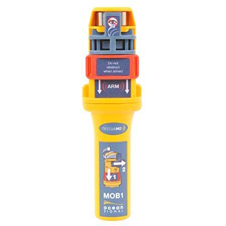
Buy from Amazon
The Ocean Signal MOB1 sends an Automatic Identification System AIS and Digital Selective Calling (DSC) distress signal when activated. This device signal can be received by most modern AIS receivers and AIS enabled plotters in the area of about 5 miles but depends on the conditions. The DSC signal can activate an alarm through your vessel’s VHF radio but other boats with VHF radios will not be alerted of the distress signal.
There is a GPS receiver in the device to determine and transmit its location. An integrated strobe helps to get a visual of the person in distress in low light and low visibility situations. The battery life for the device is 7 years and the operation life is a minimum of 24 hours. There is a 5-year warranty with the device but only two years when used in a commercial environment. A clip that connects to the inflation tube of a life jacket is also included. The weight of the device is 3.25 ounces and the dimensions are 5.3 x 1.3 x 1.0 inches.
These are commonly put in life jackets and can be set up to automatically activate when the life jacket inflates using a trigger on the back of the device. This device sends the first alert within 15 seconds of activation.
In remote areas, the best chance of being rescued in a man overboard situation is by your own vessel. The faster the crew is aware a person fell overboard the more likely they will be able to quickly retrieve the individual. The MOB1 has a feature that actives the DSC alarm over VHF radio alerting the crew of the situation.
Man Over Board Device Testing with AIS and DSC Radios
The device should be programmed with the radios MMSI and tested for proper compatibility. Then they should be installed on life jackets. On the manufactures website, there is a list of class D DSC radios that have been tested to work with the MOB1.
AIS and DSC tests can be carried out no more than three times a year. The DSC test sends a single transmission to verify that they communicate. Using an AIS test activates the GPS and sends a transmission that will show up on the chart plotter and contain the words MOB test. Doing this when first getting the device helps to verify everything is working properly.
ACR RESQLINK AIS and 406 MHz Personal Locator Beacon
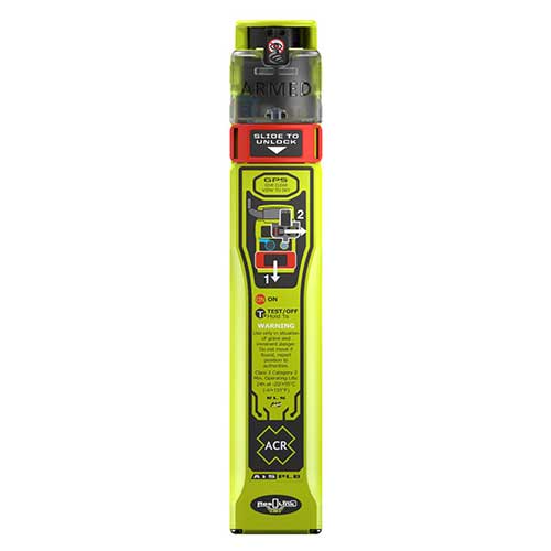
Buy from Amazon
The ACR ResQLink AIS is new device that offers the standard 406 MHz signal and the AIS signal. This makes it a great option for boats with crews where they would rescue an individual that falls overboard.
Key Features:
- Triple rescue technology: 406 MHz satellite signals, 121.5 MHz homing, and AIS local signals
- Multi-constellation GPS receiver using GPS, Galileo, and Glonass systems
- Battery life of 6 years from manufacture or 5 years after first use
- 24+ hour operational life during emergency
- Waterproof to 10 meters for 1 hour
- Compact size: 7.87″ × 1.41″ × 0.86″ (20 cm × 3.6 cm × 2.2 cm)
- Lightweight: just 0.42 lbs (190 g)
- Return Link Service confirms your distress signal was received
- Near Field Communication for smartphone connectivity
- 5-year warranty
The ResQLink AIS (PLB-450) works by sending your location globally through Cospas-Sarsat satellites at 406 MHz while simultaneously alerting nearby vessels through their AIS displays (161.975/162.025 MHz). It also transmits a 121.5 MHz homing signal to guide rescuers to your exact position.
This beacon operates in temperatures from -4°F to +131°F and can be activated manually or semi-automatically when installed in a lifejacket. While not naturally buoyant, an optional flotation pouch is available.
Perfect for all marine activities, including fishing, boating, kayaking, and paddle boarding, this device offers comprehensive protection with international approvals from Cospas-Sarsat, FCC, RED, and Canada.
5. VHF Marine Radios with DSC
Some advanced handheld marine radios include distress signaling capabilities:
Key features of DSC-enabled VHF radios:
- Send Digital Selective Calling (DSC) distress alerts with GPS position
- Can function as normal two-way radios
- Often designed to float and include emergency lights
- Some include MOB features that mark positions for navigation
- Require MMSI programming for full functionality
- Limited to marine environments where other vessels can receive the signal
Standard Horizon Floating VHF Marine Radio

Buy from Amazon
This Standard Horizon HX890 handheld radio floats and has a GPS receiver. There are Man Over Board and DSC distress functions on the radio. If the device enters the water there is a strobe light that is automatically activated. The radio is considered submersible with an IPX8 rating, which means it is waterproof at 4.92 feet for 30 minutes. The battery life is 10-hours and is rechargeable. A 12-volt quick charger is included with the radio. Transmit power levels can be set at 1W, 2W, or 6W.
The MOB function of the radio allows for a position to be saved at the time the button was pressed. The navigation feature will then bring you back to that position. For situations where the person with the radio fell overboard the DSC distress message is what would be used.
In order to send a DSC distress call, the MMSI number must be programmed. To transmit a DSC distress message lift the red spring-loaded distress cover. Then press and hold the distress key until the unit alarms. The HX870 is capable of transmitting and receiving distress messages from all DSC radios. If the GPS unit is active the latitude and longitude will be included in the distress message. The unit then waits for an acknowledgment of the distress. If an acknowledgment is not received the distress call is repeated every 4 minutes. This unit can also answer and navigate to distress calls. Check out the marine radio page to see more marine radio options.
Submersible PLB Maring Rescue GPS Radio
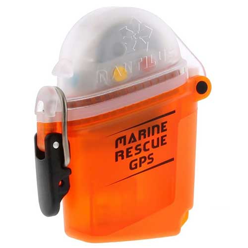
Buy from Amazon
The Nautilus Lifeline is waterproof to 425 feet with the cap closed. This device can be taken with you while scuba diving. Dimensions are 3.8 x 2.9 x 1.5 inches and it weighs 4.6 ounces. A GPS receiver is built in to allow accurate position information to be sent.
The unit comes programmed with the MID number and automatically works with all AIS-equipped ships. Your vessel MMSI number must be loaded using the optical sensor to activate DSC functionality. The device has 5-year battery life and floats.
This unit works in the same way as the other AIS devices reviewed. The Nautilus is half the size of the original submersible unit but the old model offered two-way VHF communication. This is a good unit to take with when scuba diving. The drawback of this technology is that a commercial vessel needs to be in the area to see the distress message in many cases. Diving with 406 PLB in a submersible container is typically the best option for scuba divers. When diving with my Dad one of us has the Nautilus Lifeline and the other has a PLB in a submersible container.
HDVSEATEK Scuba Dive Canister for PLB
The HDVSEATEK is a submersible dive container for PLBs and rescue beacons. It is submersible to 229 feet deep. This is made from lightweight glass-filled Nylon. No maintenance is required and the canister will not corrode. This makes opening the canister easier in an emergency. Opening the locking ring requires little force. The manufacture sells these on eBay.
This is the only submersible container that is still sold for PLB devices for scuba diving and snorkeling. There are two size options but most of the 406 PLBs fit in the small size canister. Only the GME PLB requires a large canister. For Gamin satellite messengers I am not sure which size is needed. The larger canister would likely be needed for most of them. A carry pouch for above water carrying of the pod is also included.
A diver can easily get swept away by strong currents that prevent the diver from reaching the boat again. Having a PLB or submersible dive radio on your person while driving could save your life. When we dive one person has a radio and the other person has a PLB in the waterproof canister.
I would highly recommend having a PLB in a dive canister when diving. Having spent lots of time on and near the water, I can tell you that divers do go missing because of strong currents and are difficult to locate. When diving often times there is no one left on the boat. If the boat anchor or mooring breaks free the divers would surface without a boat or any way to signal for help. Having a way to communicate the position could save your life.
Mcmurdo Dive PLB Canister
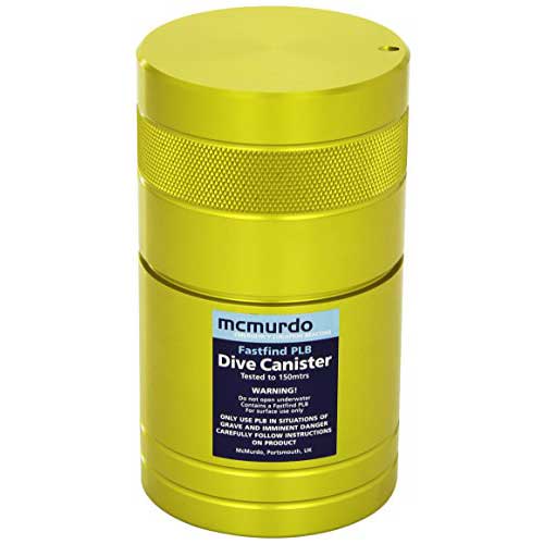
Mcmurdo Dive PLB Canister is Made from high-strength Aluminum. Dimensions are 3.68 x 6.38 inches and the weight is 1.98 pounds. This can be taken to a depth of over 450 feet. This dive canister is intended to carry a PLB with a diver while scuba diving. It is a really smart idea to dive with a GPS communication device, especially a 406 PLB.
This dive canister is not manufactured anymore. Often time you can find used ones for sale on eBay.
Stohlquist Piseas Life Jacket For PLB
Buy from Amazon
The Stohlquist Piseas life jacket is a Type III life jacket with 16.25 pounds of flotation. Sizes options are large extra-large, and double extra-large. Colors available are red or khaki.
The two zipper pockets in the front are good for holding a PLB. On the front of the jacket, there are several loops or straps to hold a strobe. This is a comfortable life jacket to wear while kayaking, fishing, or boating.
Reasons To Carry a PLB
Have a PLB When Boating By Yourself
It is especially dangerous to be boating and fishing by yourself. If you fall overboard there is no one driving the boat and no one is present to assist you or call for help. If you are fishing by yourself I would highly recommend wearing this PLB all the time!
One common way people fall overboard is when they are peeing. In one year I had three people fall off my boat when they were peeing. Luckily the water was warm and we were just drifting so it was easy to get them back on board. If you were trolling by yourself and fell overboard there is no way you could swim fast enough to get back on the boat. Having a device on you that is able to quickly transmit your position is very important.
Bring a PLB When Scuba Diving or Snorkeling
As discussed above having a PLB in a dive canister or Submersible radio is very important when diving. There are a large number of possible scenarios where a diver can be separated from the boat. Without a way to communicate your position it is very difficult to get the help you need.
Diving and snorkeling is an activity that should be taken seriously. When diving with experienced crew accidents can be minimized. However, preparing for the worst-case scenario is always the best idea. Even when snorkeling and spearfishing you can get separated from the vessel and having a PLB with you could save your life.
Have A PLB When Boating on Someone Else’s Boat
When I fish on other people’s boats I will bring my own PLB because there is no guarantee that vessel operators have good safety equipment onboard. An emergency can happen on any boat in any condition. If the boat does not have proper safety equipment it can be difficult to contact help. Most boats have basic radio communication but accidents can happen too fast for this to be effective. Cell phones do not work further than about 7 miles offshore. Satellite rescue beacons are the best way to send a distress call with position and identifying information.
Bring a PLB When Traveling to Different Countries
Traveling to different countries is awesome and there are many unique offshore locations worth exploring. In certain countries, there are little to no safety regulations. There might not even be life jackets, radios, or cell phones. PLBs that send 406 MHz distress signals offer a reliable way to send for help from anywhere in the world.
Have a PLB When Hiking in Remote Areas
More and more of the Unites State is getting good phone reception. However, there are still many wilderness areas that have canyons, hills, and mountains that block line of sight cell phone communication. Bringing a two-way satellite messenger is the best way to contact help in an emergency. Make sure that it is a true emergency though. Make an effort to independently get help and handle the situation when possible.
Common Questions About PLBs
Do I need a PLB?
During an emergency offshore or in remote areas a PLB can be the best way to quickly send a distress signal telling rescuers your position and that you need assistance. If you are in a situation where you realize that a PLB is needed to save your life but do not have one it is too late. The device needs to be on your person or in a location where it can be quickly accessed in an emergency situation. There are several types of PLBs on the market and each one has advantages based on the situation. Some offer two-way Satellite communication but required a subscription fee. Others send distress signals to government authorities and do not require a fee. AIS Man overboard beacons send signals to AIS-equipped vessels in the area and a DCS message back to your boat.
What is a PLB?
When most people say PLB they are referring to a handheld device that uses the same technology as an EPIRB. This device is registered with NOAA and during an emergency, with the push of a button, the GPS position and user identifying information are sent via satellites to emergency services. The devices also typically have a built-in strobe and a homing signal. The definition has been extended to include other handhelds devices that can send a distress signal that includes the GPS position of the device. Some of these PLBs use private satellite networks and require a subscription but also offer two-way satellite text messaging. The last type of PLB gets the GPS position of the device but only sends the signal locally to AIS equipment on commercial vessels. The AIS system can also send a DCS distress signal to the originating vessel alerting and alarm on the VHF radio.
How long does a PLB last?
The length that a PLB lasts depends on the type of device. Stand alone 406 PLBs that are only used for rescue situations typically have a battery shelf life of 5 years. The distress signal can be sent for a minimum of 24 hours. When using a satellite text message SOS rescue beacon the battery could be drained and not work at all. However, depending on the settings a charge typically lasts 24 hours or more. If the device is powered off they can keep a charge for up to a year in some devices. AIS PLBs also have a battery shelf life of about 5 years and an operational life of a minimum of 24 hours.
How do you use a Personal Locator Beacon?
Locator Beacons are typically worn on a person that can be on a life jacket, in a pocket, or in a backpack. In the event of an emergency, the antenna is deployed. The activation varies based on the device and specific instructions can be found in the user manual. For the ACR PLB view and PLB 400, the red button is pressed down for 2 seconds. This activates the device and it starts to acquire a satellite position. Once the GPS position is found which takes about two minutes it sends a distress signal over satellites to an emergency ground station. The device should be registered with NOAA and so emergency services can look up who is in distress and know the location of the distress.
At the control center, they will try and contact you via cell phone and contact your emergency contacts. If they determine it likely an emergency they will contact local rescue resources like the Coast Guard to send assistance. For emergencies on the water, help is typically sent within 30 minutes. Once rescue personnel is on the way they need to get updated position information from the device. The user needs to keep the antenna dry and pointed at the sky. There is a visual strobe and a 121.5 MHz homing signal that gets sent from the device that can help the rescue team locate the beacon faster. There is no charge for rescues as long as it was a true emergency.
Other Rescue beacons operate differently so the instructions need to be reviewed in the owner’s manual. Some devices use an SOS signal over private satellites and others only send distress locally to AIS equipment.
What is the difference between a PLB and an EPIRB?
The primary differences between a PLB and EPIRB are the size, operating time, and registration type. EPIRBs are registered to a vessel, operate for a minimum of 48 hours, and can automatically deploy and activate if a boat sinks. PLBs are registered to an individual, operate for a minimum of 24 hours, and have to be manually activated. EPIRBs and 406 PLBs also send out a 121.5 MHz homing signal and have a strobe light. There are other types of personal rescue beacons and man overboard locators that are often called PLBs but use different technology.
Will I be charged to use a PLB?
A 406 style PLB and EPIRB devices are registered to NOAA for free and use government control centers and rescue teams. When using these devices in real emergencies the user is not charged. It is important to note that the device can not be used negligently. Just because you are uncomfortable or have a minor problem does not mean that you should use an emergency distress beacon. All basic forms of communication should be tried first in non-emergency situations. This includes cell phones, radios, or satellite text messaging devices. If it is a life or limb situation the PLB should be used immediately assuming more immediate help is not available.
SOS style rescue devices like the Garmin handhelds and Spot satellite messengers require a monthly fee to send a distress signal. Distress signals are sent over private satellite networks and are initially sent to private control centers. The control center can then contact government agencies to assist with the rescue.
Captain Cody has worked on charter fishing boats in the Florida Keys, Virgin Islands, and Alaska. Growing up in Pennsylvania Cody has also done extensive freshwater fishing including bass fishing tournaments. Cody strives to provide detailed information about the best fishing gear and tactics to help both novice and experienced anglers have a more productive and enjoyable time on the water. Cody also has a background in aerospace engineering and neuroscience but really only takes pride in being good at one thing and that is fishing!

Great article. I first started back in ancient times using flashers, triangulating landmarks on shore to get on your spots. There were even some old gadgets that used radio signals on land to plot your location! It’s a wonder we lived through those adventures!
Now this old dinosaur has to figure out which one of these marvels is best for my type of fishing. I’m wanting a unit that has quality side scan for locating tuna, yellowtail, dodos, and marlin. I am also looking for an audible alarm feature. I’ll also need a quality up and down meter to keep on the depth of the fish as they stack under the boat. I also fish our channel islands for yellowtail, calico, sand and white seabass. I fish rockfish as well but rarely over 350- 400ft. I really appreciate your input and please keep in mind the dinosaur comment was only slightly tongue in cheek. Thanks.
Les Simmons
I belong to a boat club and want to know what is the best option for me to use and move from boat to boat? I need a fish finder and GPS plotter. Any recommendations?
We make a living casting a taped cast net in south ga for shrimp on the bottom of rivers and intercoastal waters. What is the very best fish finder today for that job and the price for the unit? My name is Linker
I would say most fish finders should work. I imaging the depth is pretty shallow. It would just be a matter of fine-tuning the settings and becoming familiar with what marking the shrimp looks like. I have never tried to target shrimp specifically though.
I really enjoyed this posting. I have had a Hummingbird fish finder for 28 years and want to upgrade. The technology has changed so much, or just gotten better. I feel like a fish out of water, pun intended. It’s a lot of information I will have to study more closely. I was watching a Bass Masters Tournament the other day and saw the commercials on TV and realized I was really missing out on getting the right edge on catching some quality fish. I fish small lakes 100 feet or shallower, mostly for Bass and Tiger Muskie. Any suggestions would be welcome, $800 or less.